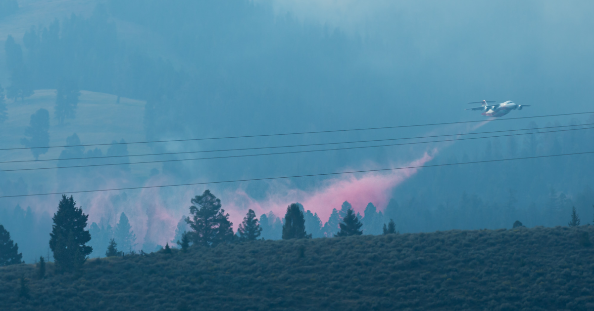
Inside Climate News 气候新闻部 在桑德克里克大火(Sand Creek Fire)期间,这场大火从8月初开始在蒙大拿州西南部燃烧,崎岖地形和被大火烧弱的树木给搜寻队伍带来了隐患,他们需要在大火掠过后的陡峭山坡上寻找仍在阴燃的区域。因此,火灾指挥官不再仅仅依靠消防员寻找隐蔽火种,而是使用无人机来搜寻热源。
Inside Climate News Climate Desk During the Sand Creek Fire, which has burned since the start of August in southwestern Montana, difficult terrain and fire-weakened trees posed hazards to crews searching for areas still smoldering on steep slopes after the blaze passed. So instead of relying only on firefighters to find hidden embers, fire managers used unmanned aircraft to seek out heat sources.
此次行动是野火应对中正在进行的更广泛技术变革的一部分。美国林务局(US Forest Service)正在评估地面灭火机器人,研究人员正在探索人工智能如何帮助预测野火起火地点以及火势蔓延速度。联邦机构已经使用无人机绘制火场地图、探测热点和实施计划烧除,并正在测试其在火灾现场投放灭火泡沫和水的能力。
The operation is part of a broader technological shift underway in wildfire response. The US Forest Service is evaluating firefighting robots on the ground, and researchers are exploring how artificial intelligence could help predict where wildfires will ignite and how quickly fires will spread. Federal agencies already use drones to map fires, detect hotspots and ignite prescribed burns, and are testing their capability to drop firefighting foam and water on blazes.
美国林务局新闻官梅雷迪斯·霍洛威尔在给 的一份声明中表示:“无人机现在已成为联邦野火应对中的关键工具,提供实时红外图像以绘制火场周界、探测热点,并监测危险或难以到达的地形,这有助于消防员做出更安全、更快速的战术决策。”
“Drones are now a critical tool in federal wildfire response, providing real-time infrared imagery to map fire perimeters, detect hotspots, and monitor dangerous or inaccessible terrain, which helps firefighters make safer, faster tactical decisions,” said Meredith Hollowell, a Forest Service press officer, in a statement to .
联邦航空管理局(Federal Aviation Administration)表示,无人机通过探测热点、绘制火场周界以及协助消防员在危险环境中的工作,提供实时态势感知。但无人机不再仅仅用于从空中监测火情。
The Federal Aviation Administration said drones provide real-time situational awareness by detecting hotspots, mapping fire perimeters and aiding firefighter efforts in dangerous environments. But drones are no longer being used just to watch fires from above.
霍洛威尔表示,在空中引燃行动中,火灾指挥官有意焚烧植被以扩大控制线或在主火势到达前清除燃料,无人机可以减少飞行员或消防员面临某些高风险状况的暴露。
During aerial ignition operations in which fire managers intentionally burn vegetation to expand control lines or remove fuels before the main fire reaches them, unmanned aircraft can reduce the exposure of pilots or firefighters to some high-risk conditions, Hollowell said.
这项技术已变得足够成熟,联邦机构现在已设立了专门的无人机系统(UAS)飞行员、管理员、模块组长和数据专家职位,以及为野火事件调配无人机资源的程序。
The technology has become established enough that federal agencies now have specific positions for UAS pilots, managers, module leaders and data specialists, as well as procedures for ordering drone resources for wildfire incidents.
森林管理局还在测试自主地面车辆,这些车辆可将装备和物资运送到常规车辆或人工运输可能困难或不安全的区域。6月,该机构及其合作伙伴在佐治亚州的崎岖地形上测试了机器人车辆,该地形旨在复现野火作业中遇到的条件。
The Forest Service is also testing autonomous ground vehicles that could carry equipment and supplies into areas where conventional vehicles or manual transport may be difficult or unsafe. In June, the agency and its partners tested robotic vehicles on rough terrain in Georgia that was designed to replicate conditions encountered during wildfire operations.
这些车辆预计可携带高达800磅的载荷,包括消防水带包、重型手动工具、水容器和医疗物资。评估人员测试了它们在携带作战载荷时穿越多石道路、不平地面和斜坡的能力。
The vehicles were expected to carry payloads of up to 800 pounds, including firehose packs, heavy hand tools, water containers, and medical supplies. Evaluators tested their ability to navigate rocky roads, uneven ground, and slopes while carrying operational loads.
虽然该技术尚未准备好用于常规野火作业,但森林管理局地区火灾管理官员查理·格雷表示,它在减少消防员面临的风险、将装备和物资送达火线方面显示出前景。
While the technology is not yet ready for routine wildfire operations, Charlie Gray, a Forest Service district fire management officer, said it shows promise for reducing firefighters’ exposure to risk while getting equipment and supplies to the fireline.
霍洛威尔表示,森林管理局预计,赋能AI的无人航空系统的进步,结合改进的火灾行为模型以及来自卫星、摄像头和天气模型的数据,将彻底改变野火探测与追踪、灭火效率和消防员安全。研究人员已经在研究将无人机与人工智能相结合的潜在优势。
Hollowell said the Forest Service expects advances in AI-enabled unmanned aerial systems, combined with improved fire-behavior models and data from satellites, cameras and weather models to revolutionize wildfire detection and tracking, suppression efficiency and firefighter safety. Researchers are already examining the potential advantages of combining drones with artificial intelligence.
爱达荷大学研究员菲尼亚斯·兰普曼开发了一套系统,利用无人机收集的热红外图像和机器学习模型来分析火灾行为并预测火势蔓延速度。根据其爱达荷大学个人简介,兰普曼在转向研究工作前,曾在克利尔沃特-波特拉奇木材保护协会和森林管理局的消防车组和精英消防队工作了七年。
Phinehas Lampman, a researcher at the University of Idaho, developed a system using thermal-infrared images collected by drones and machine-learning models to analyze fire behavior and predict a fire’s rate of spread. Lampman spent seven years working on engine and hotshot crews for the Clearwater-Potlatch Timber Protective Association and the Forest Service before turning to research, according to his University of Idaho bio.
兰普曼的研究于5月发表在《国际野地火灾杂志》上,重点关注火灾行为的三个指标:蔓延速度、火线强度和辐射功率。研究人员反复驾驶配备热红外传感器的无人机飞越一场规定燃烧的草原火灾,并利用影像生成这些特征的高分辨率测量数据。
Lampman’s study, published in May in the , focused on three measures of fire behavior: rate of spread, fireline intensity, and radiative power. Researchers repeatedly flew a drone equipped with a thermal-infrared sensor over a prescribed grassland fire and used the imagery to generate high-resolution measurements of those characteristics.
兰普曼及其同事利用无人机收集的数据训练机器学习模型,以预测火势蔓延的速度。研究人员报告称,这些模型在实验期间的短期预测表现良好。能够直接从火场收集观测数据、供机器学习系统分析以预测火灾下一步动向的无人机,可能成为事件指挥官工具箱中的宝贵补充。
Lampman and his colleagues used the drone-collected data to train machine learning models to predict how quickly the fire would spread. The models performed well in making short-term predictions during the experiment, the researchers reported. Drones that can collect observations directly from a fire for machine-learning systems to analyze for their predictions of what the blaze may do next could be a valuable addition to incident commanders’ toolbox.
火灾管理者目前依靠多种信息来源做决策,包括天气报告、地图、消防员的观察以及飞机和直升机提供的空中信息。
Fire managers currently make decisions using multiple sources of information, including weather reports, maps, observations from firefighters and aerial information from airplanes and helicopters.
兰普曼在爱达荷大学8月发表的一篇文章中说:“现场大多数事件指挥官依靠其丰富的经验来评估并最终预测野火蔓延。”但虽然常规飞机能提供关键信息,却无法在所有条件下作业。
“Most incident commanders in the field rely on their vast experience to assess and ultimately predict wildfire movement,” Lampman said in an August article published by the University of Idaho. But while conventional aircraft can provide critical information, they cannot operate in all conditions.
兰普曼说:“有时那些空中资产会被迫停飞,或者能见度非常差。但无人机通常仍能飞行并收集信息。”这不仅能让无人机成为火场上空的另一双眼睛,还能使其成为旨在估算火灾行为的模型的数据来源。
“Sometimes those aerial assets are grounded, or the visibility is really poor,” Lampman said. “But drones can usually still fly and gather information.”That could make drones useful not only as another set of eyes over a fire, but also as a data source for models designed to estimate fire behavior.
兰普曼的研究仍处于概念验证阶段,目前尚无火灾管理者可依赖的AI系统来准确预测野火蔓延。但联邦消防官员已着眼于未来,届时无人机、人工智能和其他技术可协同工作,为消防员提供更多信息,同时减少他们面临危险境地的风险。
Lampman’s research remains a proof of concept, and no AI system yet exists that fire managers can rely on to accurately predict a wildfire’s movement. But federal fire officials are already looking toward a future in which drones, artificial intelligence, and other technologies could work together to give firefighters more information while reducing their exposure to dangerous situations.
“展望未来,借助人工智能技术的无人机系统、改进的火灾行为建模工具以及决策支持工具的广泛应用,再加上卫星数据、摄像头图像和天气模型的整合,预计将提升火灾的早期发现能力、追踪效率以及消防员的安全性,”美国林业局的霍洛韦尔(Hollowell)表示。
“Looking ahead, advances in AI-enabled UAV systems, improved fire-behavior modeling, and expanded use of decision-support tools, along with satellite, camera, and weather-model integration, are expected to enhance early detection, tracking, suppression efficiency, and firefighter safety,” said Hollowell, at the US Forest Service.
研究人员还在探索无人机收集的数据如何有助于改进关于野火烟雾及其对下游地区人群潜在影响的模型。
Researchers are also exploring how drone-collected data could improve models of wildfire smoke and its potential effects on people downwind.
“无人机为研究人员提供了关键的信息来源,帮助他们实时了解火灾行为与烟雾排放之间的关系,”爱达荷大学野生火科学教授莱达·科布齐亚尔(Leda Kobziar)在电子邮件中说道。“这些关系对于构建和完善相关模型(包括人工智能模型)至关重要,这些模型能够帮助我们预测下游地区人们可能会接触到的烟雾中的微生物种类及其浓度。”
“UAS provide critical access to researchers who are expanding our understanding of the relationships between fire behavior and smoke emissions in real time,” Leda Kobziar, a professor of wildland fire science at the University of Idaho and a co-author of the study, said in an email to . “These relationships are key to building and improving models (including AI models) that can help us predict what types of smoke-borne microbes and concentrations of smoke we would expect people downwind to be exposed to.”