在洪水浪潮席卷博特科希河及其支流之前,研究人员就已经开始计算下游地区究竟有多少人生活在可能遭受灾难性洪水威胁的区域。这些区域的水流源自尼泊尔的高山盆地。他们得出的数字约为29.4万人,并且还在持续增加,这清楚地表明,在这个国家,有大量人口居住于极端高风险区域。气候变化正在破坏喜马拉雅山坡的岩石和冰层结构,而融水则在越来越多的冰川湖中积聚。
Long before a wave of water rushed down the Bhote Koshi river and its tributaries, researchers were working to calculate just how many people are living downstream and exposed to potentially catastrophic flood risk in the areas that drain from Nepal’s high mountain basins. The number they came up with — about 294,000 and growing — shows just how many people are living in areas of extreme risk in a country where climate change is destabilizing the rock and ice holding Himalayan slopes together and where meltwater is pooling in an ever-growing catalog of glacial lakes.
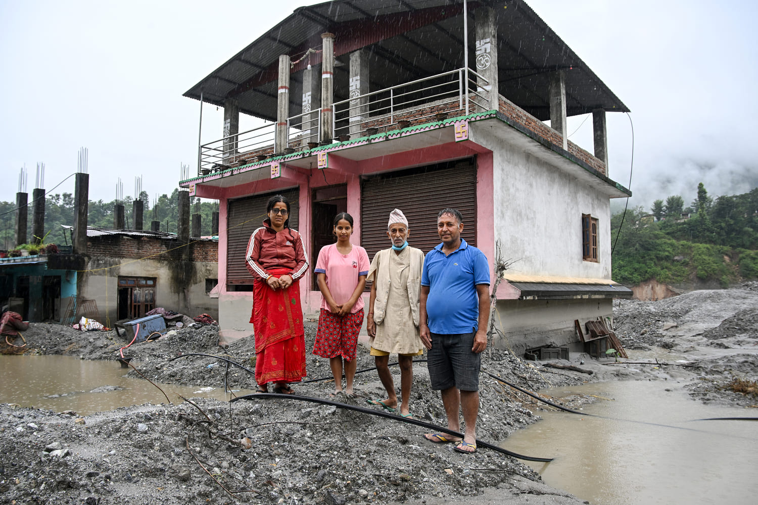
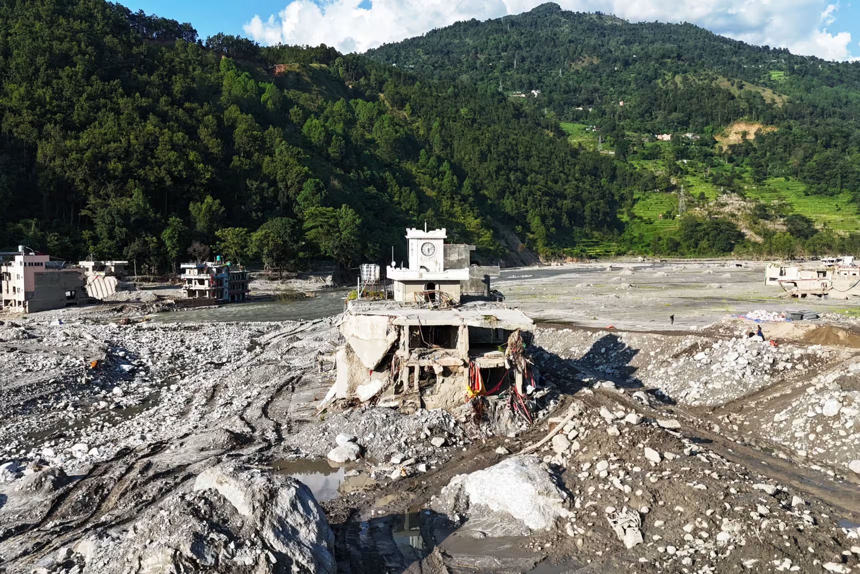
英国利兹大学研究冰川湖的高级研究员斯科特·沃森表示:“对尼泊尔而言,这一结果说明,在这些潜在危险区域,有大量开发活动正紧挨着河道进行。这些活动主要受旅游业和贸易路线的推动。最近发生的灾难就发生在尼泊尔与青藏高原之间的主要贸易路线上。”根据尼泊尔当局的统计,今年8月发生的灾难中,一场巨大的岩石和冰体雪崩从海拔近24000英尺的朗塘利龙峰上坠落,引发了一场绵延约120英里的泥石流,造成至少1455人死亡,另有至少5285人失踪,近1.4万人获救。
“For Nepal, it shows that there’s a lot of development going on very close to the river channel in these potentially hazardous zones,” said Scott Watson, a senior research fellow at the University of Leeds in England who studies glacial lakes. “That’s driven by tourism and the trade routes. The recent disaster was on the main trade route between Nepal and the Tibetan plateau.”The August disaster — when a massive rock and ice avalanche plunged off the an almost 24,000-foot peak called Langtang Lirung and caused a debris flow that traveled more about 120 miles — killed at least 1,455 people, and at least 5,285 people are still missing, according to Nepali authorities.
研究人员指出,如果不采取任何措施,暴露在风险中的人口只会继续增加。沃森说:“希望这次不幸的近期灾难能成为一个警钟,提醒尼泊尔必须更加重视早期预警系统,同时也要加强土地用途规划。我们的研究显示,有大量建筑物和居民紧邻河道,面临着这些灾害风险。”研究人员发现,其中约10.8万人位于冰川湖的下游。
Nearly 14,000 people were rescued. If nothing is done, researchers say the number of people exposed will only grow. “Hopefully, for Nepal, it’s kind of a bit of a wake-up call, this unfortunate recent disaster, in that there needs to be obviously a lot more focus on thinking about early warning systems, but also land use zoning,” Watson said. “We show that there’s a lot of buildings, there’s a lot of people very close to the river channel that are exposed to these hazards.”About 108,000 of those people are downstream of glacial lakes, the researchers found.
这些冰川湖中的许多都是被冰层拦截形成的水体,一旦冰层崩溃,就可能瞬间释放出大量洪水。
Many of those glacial lakes are pools of water dammed by ice that could fail and release a flush of water all at once.
研究人员于2025年秋季开始着手这项分析,但此后数月都经历了学术同行评审。周四,他们首次在《科学报告》期刊上发表了研究结果。这项研究最好被看作一份关于尼泊尔高山附近洪水风险的大致轮廓——更详尽的分析仍有必要。研究人员通过绘制所有发源于尼泊尔与西藏、印度接壤的跨境地区河流的地图来进行分析。
The researchers started putting together this analysis in fall 2025, but it spent months undergoing academic peer view. They published their findings for the first time in the journal Scientific Reports on Thursday. The research is best viewed as a rough draft of where flood risk exists near Nepal’s high peaks — more thorough analysis is still needed. The researchers performed their analysis by building a map of all rivers that originate in the transboundary areas of Nepal along the border with Tibet and India.
他们圈定了冰川湖或河流流域源头下游50公里(即31英里)范围内的区域。随后,他们绘制了若下游水位上涨50米(即164英尺),哪些地区会被洪水淹没。研究人员发现,在冰川湖下游约有10.8万人处于风险之中,这些冰川的冰层一旦崩塌,就可能引发洪水波迅速向下游蔓延。水位上涨164英尺、洪水流速覆盖31英里,听起来或许像是极不寻常的事件。
They isolated areas within 50 kilometers, or 31 miles, downstream of glacial lakes or the headwaters of a river basin. Then, they mapped what would be exposed to floodwaters in a flood with 50 meters, or 164 vertical feet, of rising water downstream. The researchers found about 108,000 people downstream of glacial lakes with ice that could fail and send a pulse of floodwater racing downstream. Floods that rise 164 vertical feet and travel 31 miles might sound like an extraordinary occurrence.
然而,联合国大学环境与人类安全研究所的高级科学家迪佩什·查帕加因表示,今年8月博特科希河及其支流发生的洪水,洪水流速曾覆盖下游约120英里,并在部分社区使水位上升了约330英尺。“这一风险甚至可能比论文中提出的还要高,”这位研究气候变化和洪水的尼泊尔科学家说道,“这次事件设定了一个新的水平,一个新的阈值。”
However, the August flooding in the Bhote Koshi river and its tributaries traveled about 120 miles downstream and raised water levels by roughly 330 feet in some communities, said Dipesh Chapagain, a senior scientist at the United Nations University Institute for Environment and Human Security. “The risk could even be higher” than the paper suggests, said Chapagain a Nepali scientist who studies climate change and flooding. “This event set a new level, a new threshold.”
与美国不同,尼泊尔大部分地区尚未具备详细的洪水灾害地图。沃森表示,此前试图了解尼泊尔有多少人口面临源自高山的危险洪水的研究,通常只是围绕高山河流划定1公里(0.62英里)的缓冲区。沃森指出,这项新研究将有助于确定洪水灾害地图绘制工作的优先区域。
Unlike the U.S., detailed flood hazard mapping is not available for much of Nepal. Watson said previous efforts to understand what portion of Nepal’s population is exposed to dangerous flooding that originates in the high mountains simply drew 1-kilometer (.62-mile) buffers around alpine rivers. Watson said the new research will inform where flood hazard mapping should be prioritized.
“我们正在收集极高精度的高程模型,以生成部分详细洪水风险图,从而能够重点关注最易受影响的热点区域,”沃森说道。“要达到这种细节程度,我们实际上需要一种筛选工具来明确哪些地方是这些热点区域。”在尼泊尔博特科希河洪水事件发生一个多月后,搜寻失踪人员的行动最终被叫停。查帕加恩表示,目前的工作重点是为数千名洪水灾民建造临时安置点。
“We’re collecting very high-resolution elevation models to run some of the detailed flood hazard maps so we can focus on the most exposed hot spots,” Watson said. “To get into that level of detail, we kind of had to have this screening tool to say, you know, where are the hot spots?”After more than a month of searching for missing people in the Bhote Koshi flooding, Nepal called off its search. The focus now, Chapagain said, is to build temporary settlements for thousands of flood victims.
尽管尚未有明确的永久安置计划,但查帕加恩强调,新建设施必须优先在安全区域进行。“未来的规划在策划新的基础设施项目、新社区以及洪水恢复项目时,应全面考虑这些风险,”查帕加恩补充道,并指出该研究认定的高风险区域应优先建设洪水预警系统。沃森表示,这项研究揭示出尼泊尔过度开发和建设活动缺乏有效监管。
There is not a concrete plan yet for how to approach permanent resettlement, but Chapagain said new construction must be prioritized in safe areas. “Future planning should consider all these risks when planning for new infrastructure projects, new settlements and also for the flood recovery projects,” Chapagain said, adding that flood early-warning systems should be prioritized in areas this study identified as high-risk. Watson said the study shows that too much construction and development in Nepal has not been regulated.
水电投资和旅游业在尼泊尔蓬勃发展,使得铺砌道路延伸至高山集水区。研究发现,2016年至2023年间,河流两岸50米垂直范围内的人工建筑面积增加了约46%。“一旦这些社区开始形成,配套的生活设施也会随之而来,比如学校和医疗资源——结果可能很快就在紧邻河道的区域形成一个不断增长的社区,”沃森说道。与此同时,他还指出,随着冰川消失和气候变暖导致永久冻土融化,上游正在形成数千个冰川湖——其中许多湖泊可能在毫无征兆或预警的情况下,突然向下游释放大量洪水。
Hydropower investment and tourism are booming in Nepal, which has brought paved roads into high mountain catchments. The study found that the amount of area built within 50 vertical meters of riverbanks increased by approximately 46% from 2016 to 2023. “Once those communities start to form, the amenities soon follow, your schools, your healthcare — you can quite quickly end up with a growing community in an area that’s actually very close to the river channel,” Watson said. Meanwhile, he said thousands of glacial lakes are forming upstream as glaciers disappear and permafrost thaws due to climate change — and many could send a pulse of floodwater downstream with little notice or warning.