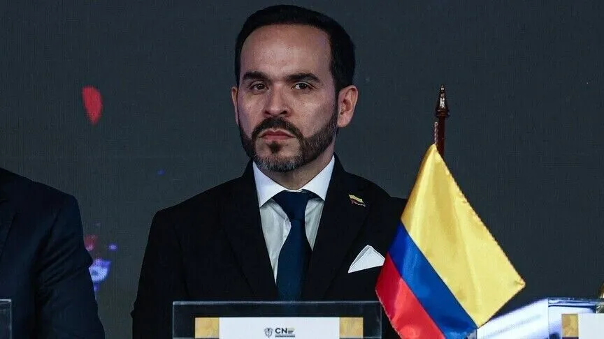
哥伦比亚总统阿贝拉尔多·德拉·埃斯普里亚周日在全国讲话中宣布,他将签署一项总统令,正式确立圣安德烈斯、普罗维登西亚和圣卡塔利纳群岛的基线和海上边界。
Colombian President Abelardo De la Espriella announced in a national address Sunday that he will sign a presidential decree formally establishing the baselines and maritime boundaries of the San Andres, Providencia and Santa Catalina Archipelago.
德拉·埃斯普里亚在圣安德烈斯海岸外的一艘海军舰艇上发表讲话时表示,这些坐标将被纳入哥伦比亚的官方海图,以解决追溯至1978年8月4日第10号法律的历史债务。虽然该法律规定了技术基线,但大陆坐标是在1984年确定的,当时并未将等效的基线技术定义应用于岛屿领土。
Speaking from a naval vessel off San Andres, De la Espriella said the coordinates will be incorporated into Colombia's official nautical charts to settle a historical debt dating back to Law 10 of August 4, 1978. While that law mandated technical baselines, mainland coordinates were established in 1984 without applying equivalent baseline technical definitions to the insular territory.
“今天将偿还对共和国的债务,”德拉·埃斯普里亚宣称,他选择了11月30日——圣安德烈斯的节日,也是该岛守护圣人庆典的日子——作为官方日期。
“That debt to the Republic will be settled today,” De la Espriella declared, selecting Nov. 30 -- the feast day of San Andres and patron saint celebration of the island -- for the officialg.
“哥伦比亚不会放弃一海里。我们的海军将始终准备好依法行动……不多于法律承认的一米,也不少于属于我们的一米。”总统强调,该措施是对国家主权和海洋管辖权的主张,使哥伦比亚能够精确计算其领海和专属经济区。
“Colombia will not cede a single nautical mile. Our Navy will always be ready to act in accordance with the law ... Not a single meter more than what the law recognizes, nor a single meter less than what belongs to us.”The president stressed that the measure serves as an assertion of state sovereignty and maritime jurisdiction, enabling Colombia to precisely calculate its territorial sea and exclusive economic zone.
作为全面领土防御政策的一部分,德拉·埃斯普里亚 affirmed that unauthorized economic, scientific or exploratory activities would not be permitted within Colombian-claimed waters.该声明是在哥伦比亚与尼加拉瓜长期存在的海上争端背景下作出的,该争端正在国际法院(ICJ)审理中。
As part of a comprehensive territorial defense policy, De la Espriella affirmed that unauthorized economic, scientific or exploratory activities would not be permitted within Colombian-claimed waters. The announcement comes against the backdrop of a long-standing maritime dispute between Colombia and Nicaragua before the International Court of Justice (ICJ).
2012年,法院确认了哥伦比亚对圣安德烈斯、普罗维登西亚和圣卡塔利纳群岛以及关键周边礁岛的主权,但重新划定了海上边界,赋予尼加拉瓜一个扩大的经济专属区。
In 2012, the court confirmed Colombian sovereignty over the islands of San Andres, Providencia and Santa Catalina alongside key surrounding cays but redrew maritime boundaries, granting Nicaragua an expanded economic zone.
2023年,法庭驳回了尼加拉瓜对与哥伦比亚200海里海域重叠的大陆架延伸主张的请求。
In 2023, the tribunal rejected Nicaragua’s extended continental shelf claim that overlapped with Colombia’s 200-nautical-mile maritime area.
通过正式在官方航海文件中公布基线坐标,德拉埃斯普里耶拉政府旨在从技术层面巩固其海洋边界,加强加勒比海地区的安全、商业航行和当地渔业权利。
By formally publishing the baseline coordinates in official nautical documents, the De la Espriella administration seeks to technically consolidate its maritime perimeter and bolster security, commercial navigation and local fishing rights across the Caribbean.
在主权措施并行的同时,圣安德烈斯、普罗维登西亚和圣卡塔利纳群岛的财务管理不当指控促使国家政府请求哥伦比亚最高监督机构进行协调干预。该倡议旨在调查当地公共采购中可能存在的违规行为,重点针对被怀疑干涉政府合同并挪用公共资金的政治网络。
Parallel to the sovereignty measures, allegations of financial mismanagement in the San Andres, Providencia and Santa Catalina archipelago have prompted the national government to request coordinated intervention by Colombia’s top oversight authorities. The initiative seeks to investigate potential irregularities in local public procurement, targeting political networks suspected of interfering in government contracts and misdirecting public funds.