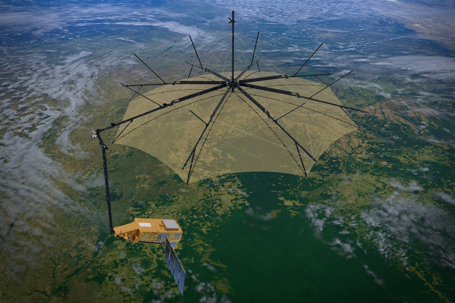
每隔三天,当欧洲空间局(ESA)的生物质卫星以每小时27,000公里的速度穿越天空时,它会飞越刚果雨林内的一个特定点——这片位于非洲心脏地带的广袤绿洲。在完成这一轨道运行时,卫星会将数据传回地球,使科学家能够拼凑出一幅3D扫描图,以监测森林的健康状况。
Once every three days, as the European Space Agency’s Biomass satellite races across the sky at a speed of 27,000 kilometres per hour, it passes over a specific point within the Congo rainforest, the mighty expanse of greenery in the heart of Africa. As it completes this circuit, the satellite beams data back to Earth, allowing scientists to piece together a 3D scan to monitor the health of the forest.
生物质卫星于2025年4月从法属圭亚那发射升空,是日益增多的用于调查地球森林的卫星之一。它独特地使用了P波段合成孔径雷达(SAR)。通过发射能够穿透森林冠层的超长波无线电波,卫星能够测量树干和树枝,这为所储存的碳量提供了一个替代指标。
Biomass, launched from French Guiana in April 2025, is one of a growing number of satellites tasked with surveying the Earth’s forests. Uniquely, it uses P-band synthetic aperture radar (SAR). By transmitting ultra-long radio waves that penetrate the forest canopy, the satellite can measure tree trunks and branches, which provides a proxy for the amount of carbon being stored.
空间与气候(Space4Climate)公私合作伙伴关系的气候服务发展经理唐娜·林德赛表示,像生物质这样的卫星对雨林保护“绝对必不可少”。该机构致力于推动卫星数据在气候行动中的应用。
Satellites like Biomass are “absolutely essential” for rainforest conservation, says Donna Lyndsay, climate services development manager at Space4Climate, a public-private partnership that promotes the use of satellite data for climate action. She notes that cutting-edge satellites are now orbiting the Earth at a greater cadence, providing increasingly high-resolution spatial imagery that can offer early warning signs of any deterioration in forest health.
她指出,尖端卫星如今以更高的频率绕地球运行,提供了越来越高分辨率的空间影像,能够为森林健康状况的任何恶化提供早期预警信号。
As the pace of climate change escalates, monitoring threats to tropical forests – and, ultimately, intervening to counter these threats – has never been so important.
随着气候变化步伐的加速,监测热带森林面临的威胁——以及最终干预以应对这些威胁——从未如此重要。
L-band SAR, a less advanced technology than P-band, has been key to helping scientists realise that Africa’s forests and woody savannahs have already passed a tipping point.
L波段SAR是一种相比P波段技术较为落后的技术,但它在帮助科学家认识到非洲的森林和木本稀树草原已经超过临界点方面发挥了关键作用。
According to findings published in the journal Scientific Reports, rapid deforestation means these African biomes have been releasing more carbon than they sequester since 2010.
根据发表在《科学报告》期刊上的研究结果,快速的森林砍伐意味着这些非洲生物群落自2010年以来一直在释放的碳多于其吸收的碳。
Alongside continuous innovation in the hardware of satellites, breakthroughs on the software side are enabling scientists to make ever-greater use of satellite data.
随着卫星硬件的持续创新,软件方面的突破正使科学家能够更大程度地利用卫星数据。
“We have now, through the use of AI capabilities, the ability to really interrogate these datasets on a massive scale,” says Lyndsay.
“我们现在通过使用人工智能能力,能够真正以大规模方式审查这些数据集,”林赛说。她表示,这正在为预测分析的显著扩展铺平道路。例如,一家公司可能会收到警报,提示其供应商所在地区已检测到即将发生的森林砍伐信号。凭借这些数据,公司可以考虑采取预防性行动。
This is paving the way for a significant expansion in predictive analytics, she says. A company might, for example, receive an alert that signals of impending deforestation have been detected within areas from which its sources commodities. Armed with this data, the company could then consider taking preventative action. The Congo rainforest stretches across Cameroon, the Central African Republic, Congo-Brazzaville, Equatorial Guinea and Gabon, as well as DR Congo itself.
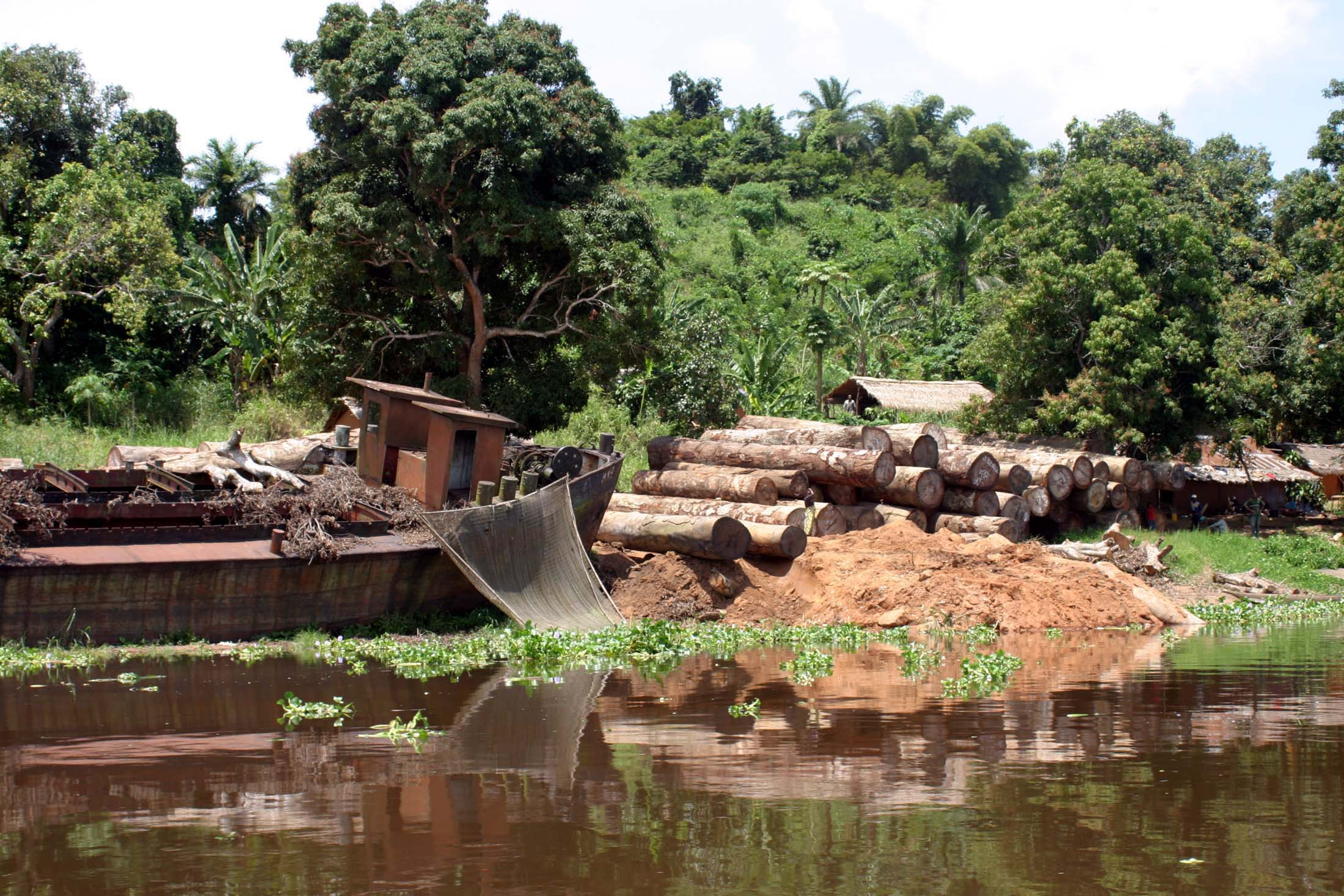
刚果雨林横跨喀麦隆、中非共和国、刚果-布拉柴维尔、赤道几内亚和加蓬,以及刚果民主共和国本身。由于其大部分地区几乎无法通过公路到达,卫星提供了监测森林砍伐威胁的唯一实际方式。
With much of its expanse virtually inaccessible by road, Satellites offer the only practical way of keeping track of deforestation threats. “I don't think there's any way that we could possibly have oversight of all natural forests globally, without having some sort of bird’s-eye view of what's going on,” says Lucy Barnes, a senior manager for supply chain solutions at the Earthworm Foundation.
“我认为我们不可能在没有某种鸟瞰视角的情况下,对全球所有自然森林进行监督,”地球虫基金会供应链解决方案高级经理露西·巴恩斯说。该非营利组织自2016年起一直与空客合作运营一个名为“星光”的卫星监测平台,该平台能够向主要公司发出其供应链中存在森林砍伐风险的警报。
The non-profit has been running a satellite monitoring platform called Starling with Airbus since 2016 that can alert major companies to risks of deforestation in their supply chains. Improved technology will open new possibilities for using satellite data, Barnes adds.
巴恩斯补充说,改进的技术将为利用卫星数据开辟新的可能性。“这不一定只是用于监测森林砍伐。我认为在某种程度上,我们现在能够以非常高的水平做到这一点。你也可以利用这些数据来回答其他环境问题,例如测量碳封存。”事实上,碳市场领域的多个参与者已经在广泛使用卫星数据。人们希望卫星数据甚至能够帮助解决一些长期存在的问题,这些问题一直削弱这些市场的增长。
“It's not necessarily about using it just for monitoring deforestation, as such. I think in some ways, we’re able to do that to a very high level now. It's how you can also use that data for answering other environmental questions, for example, measuring carbon sequestration.”Indeed, multiple actors in the carbon markets space are already making extensive use of satellite data. The hope is that satellite data could even help solve some of the longstanding problems that have undermined the growth of these markets. REDD+ carbon credit schemes have been heavily promoted as a way to avoid emissions linked to deforestation, yet these schemes have repeatedly been criticised for alleged “over-crediting”.
REDD+碳信用计划被大力推广为避免与森林砍伐相关排放的一种方式,但这些计划反复受到所谓“过度授予信用”的批评。
In a notorious example, project developer Carbon Green Investments and environmental consultancy South Pole grossly overstated the rate of deforestation in a “reference area” close to the forest they were seeking to preserve through the Kariba REDD+ project in Zimbabwe.
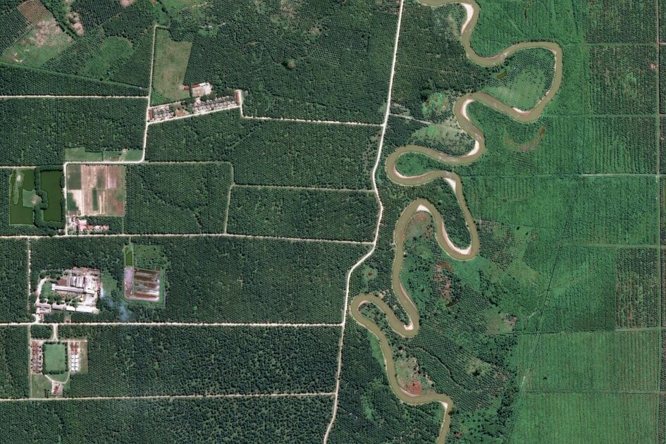
在臭名昭成的案例中,项目开发商碳绿投资公司和环保咨询公司南极圈严重夸大了位于津巴布韦卡巴伊REDD+项目“参考区域”内的森林砍伐速度——该区域正是他们试图通过该项目保护下的森林。
This allowed the developer to claim its interventions within the project area made a greater impact in avoiding emissions than was truly the case.
这使开发商得以声称其项目区域内实施的干预措施在避免排放方面产生了更大的影响,而实际情况并非如此。经过漫长的调查,碳市场注册机构Verra去年发现该项目发行的碳信用额度是其实际应发额度两倍以上。
Following a lengthy investigation, carbon markets registry Verra found last year that the project had issued more than twice as many credits as it should have done. In the wake of these reputational disasters, the price of avoided deforestation credits remains depressed.
在声誉遭受这些灾难性打击之后,避免森林砍伐的碳信用价格依然低迷。据碳市场情报公司Sylvera的数据,即使是评级较高的REDD+信用额度也仅约每吨7美元。相比之下,通过植树造林或重新造林去除碳的高评级项目平均价格为每吨26.10美元。
Even higher-rated REDD+ credits trade at only around $7 per tonne, according to data from carbon markets intelligence firm Sylvera. By comparison, high-rated projects that remove carbon through reforestation or afforestation average $26.10 per tonne. Yet experts agree that there is no higher priority for climate and biodiversity than protecting existing forest habitats.
然而,专家一致认为,保护现有森林栖息地对气候和生物多样性而言没有更高的优先级。换言之,市场上存在一种错位:造林的经济价值与最初避免森林砍伐的保护价值之间存在不匹配。
In other words, there is a misalignment in the market between the financial value of afforestation versus the conservation value of avoiding deforestation in the first place. Satellite monitoring could help solve this conundrum.
卫星监测有望解决这一难题。碳评级机构BeZero Carbon的副总裁兼地球观测高级副总裁Phil Platts指出,较新的避免森林砍伐方法——如Verra的VM0048——将确定森林砍伐基线的工作从项目开发商转移到了注册机构。
Phil Platts, senior vice president for geospatial and Earth observation at carbon ratings agency BeZero Carbon, notes that newer avoided deforestation methodologies – such as Verra’s VM0048 – take responsibility for determining the baseline used to calculate deforestation rates away from project developers. Instead, registries use satellite imagery to calculate deforestation rates across a country or province; credit issuance is then based on comparing deforestation in the project area with the wider jurisdiction.
取而代之的是,注册机构利用卫星影像计算一个国家或省份范围内的森林砍伐率;信用额度的发放则基于项目区域与更广泛管辖范围之间的森林砍伐对比得出。
The “systematic over-crediting” that once marred avoided deforestation projects “just isn’t there with these new methodologies,” Platts says.
Platts表示:“曾经困扰避免森林砍伐项目的'系统性过度核证'问题,在这些新方法中已经不存在了。”
Despite these advances, the carbon markets remain controversial.
尽管取得了这些进展,碳市场仍然充满争议。雨林基金会英国执行董事乔·艾森将这一市场描述为“一场愚蠢的实验”,并警告称,收入并未流向最需要的地方的社区。
Rainforest Foundation UK’s executive director Joe Eisen describes the market as a “folly” in the forests of central Africa, warning that revenues are “not filtering down to communities where it's most needed”. Nevertheless, Rainforest Foundation UK is working on a pilot project in 30 community forests in the Democratic Republic of Congo, in which communities receive payments based on protecting forest cover.
尽管如此,雨林基金会英国正在刚果民主共和国30个社区森林中开展试点项目,社区根据保护森林覆盖面积获得付款。艾森表示,结果的验证“完全基于卫星数据”。
The verification of results is “based entirely on satellite data”, Eisen says. The NGO also operates a satellite monitoring platform called ForestEye, which can provide community forest monitoring groups with access to intelligence on disturbance to the forest canopy.
该非政府组织还运营着一个名为ForestEye的卫星监测平台,可为社区森林监测团体提供关于森林冠层受扰动的情报。
As both hardware and software continues to improve, satellite technology will play an increasingly key role both in monitoring forest carbon projects, and in supporting rainforest conservation more generally.
随着硬件和软件持续改进,卫星技术将在监测森林碳项目以及更广泛的雨林保护方面发挥越来越关键的作用。
One company pushing the boundaries of what satellite monitoring can do is ICEYE, a Finland-headquartered company that operates the world’s largest constellation of SAR satellites.
一家在边界上拓展卫星监测能力的企业是芬兰公司ICEYE,该公司运营着全球最大的SAR卫星星座。
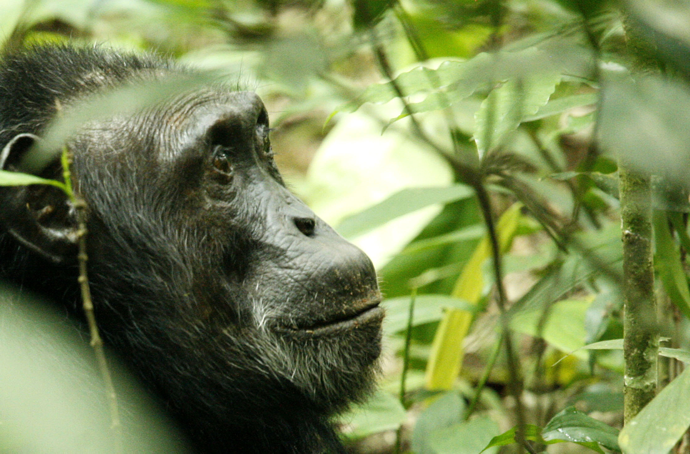
In April, it announced a partnership with the Jane Goodall Foundation to support chimpanzee conservation in eastern DRC by using SAR to detect threats such as logging and illegal mining.
今年4月,该公司宣布与珍恩·古道尔基金会合作,利用SAR技术检测伐伐和非法采矿等威胁,以支持东部刚果的大猩猩保护工作。
Michael Bennett, ICEYE’s head of government solutions, says conventional satellite monitoring is insufficient in this region, which is blanketed by thick clouds for much of the year.
ICEYE政府解决方案负责人迈克尔· Bennett表示,在该地区,卫星监测手段不足以应对挑战,因为该地区大部分时间被浓密的云层覆盖。非法活动很容易在茂密的森林树冠下被掩盖而不被发现。
Illegal activities can easily remain undetected beneath the thick forest canopy. “With SAR, you don't need to get lucky,” he says.
“有了SAR,你不需要碰运气,”他说。正如欧洲空间局的Biomass卫星一样,ICEYE卫星发射的雷达波可以穿透云层和树冠,构建出三维图像,从而更容易发现潜在威胁。
Much like the ESA’s Biomass satellite, the radar beams transmitted by ICEYE’s satellites can penetrate both cloud and canopy cover to build a 3D image that make it easier to detect possible threats. And while conservation organisations might traditionally rely on satellite images that are several months, or even years, out of date, Bennett stresses that ICEYE’s constellation of dozens of satellites in low Earth orbit mean the company can provide “near-real time” coverage.
而且,尽管保护组织传统上可能依赖几个月甚至数年才更新的卫星影像,贝内特强调,ICEYE 在低地球轨道部署的数十颗卫星星座意味着该公司能够提供“近实时”的覆盖。
Of course, gaining these kinds of insights is only the first step.
当然,获取此类洞察仅是第一步。仍然存在如何在政府权力至多有限的环境中进行干预的问题。
There is still the problem of how to intervene in an environment where the government’s authority is limited at best. With a more accurate picture of threats to chimpanzees, however, Bennett suggests the Jane Goodall Foundation will be able to become more proactive in alerting authorities and on-the-ground team to the need for action.
然而,凭借对黑猩猩威胁更为精准的了解,贝内特指出,简·古道尔基金会将能够在提醒当局和现场团队采取行动的需求上更加主动。
Sassan Saatchi is CEO of CTrees, a platform that offers free access to data on carbon sequestration down to the level of an individual tree.
萨桑·萨奇是 CTrees 的首席执行官,该平台提供对碳汇数据的免费访问,细化到单棵树的层面。虽然赞扬卫星技术的进步,他表示仍需进一步努力,确保日益丰富的数据来源真正被当地团队用于碳项目以及更广泛的保护工作。“他们可以使用的大量免费材料和技术,”他说,“如果他们使用,这将是一次重大改变。”
While hailing the advances in satellite technology, he says more work is needed to ensure that increasingly abundant sources of data are actually used by local teams, both in carbon projects and in broader conservation efforts. “There is so much free material and technology they can use,” he says. “If they use it, it would be a significant change.”
中非大森林及其丰富生物多样性面临的危险仍然严峻。过去十年,刚果民主共和国的原始森林每年约损失 0.5%,主要是由于小规模农业的侵占。喀麦隆在 2025 年经历了有史以来最严重的森林砍伐,部分原因是可可种植园的扩张。
The dangers facing the great forests of central Africa and their wealth of biodiversity remain formidable. DRC has been losing roughly 0.5% of its primary forests each year over the past decade, largely due to encroachment of small-scale agriculture. And Cameroon suffered its worst ever year of deforestation in 2025, partly driven by the growth of cocoa plantations.
得益于卫星数据,政府、非政府组织和企业对非洲森林健康的了解比以往任何时候都更清晰。现在的挑战是,在卫星工具的帮助下,寻找方法确保这些绿色肺部能够永续生存。
Thanks to satellite data, governments, NGOs and companies have a clearer picture than ever before on the health of Africa’s forests. The challenge now, with the help of satellite tools, is to find ways to ensure these green lungs can survive forever.