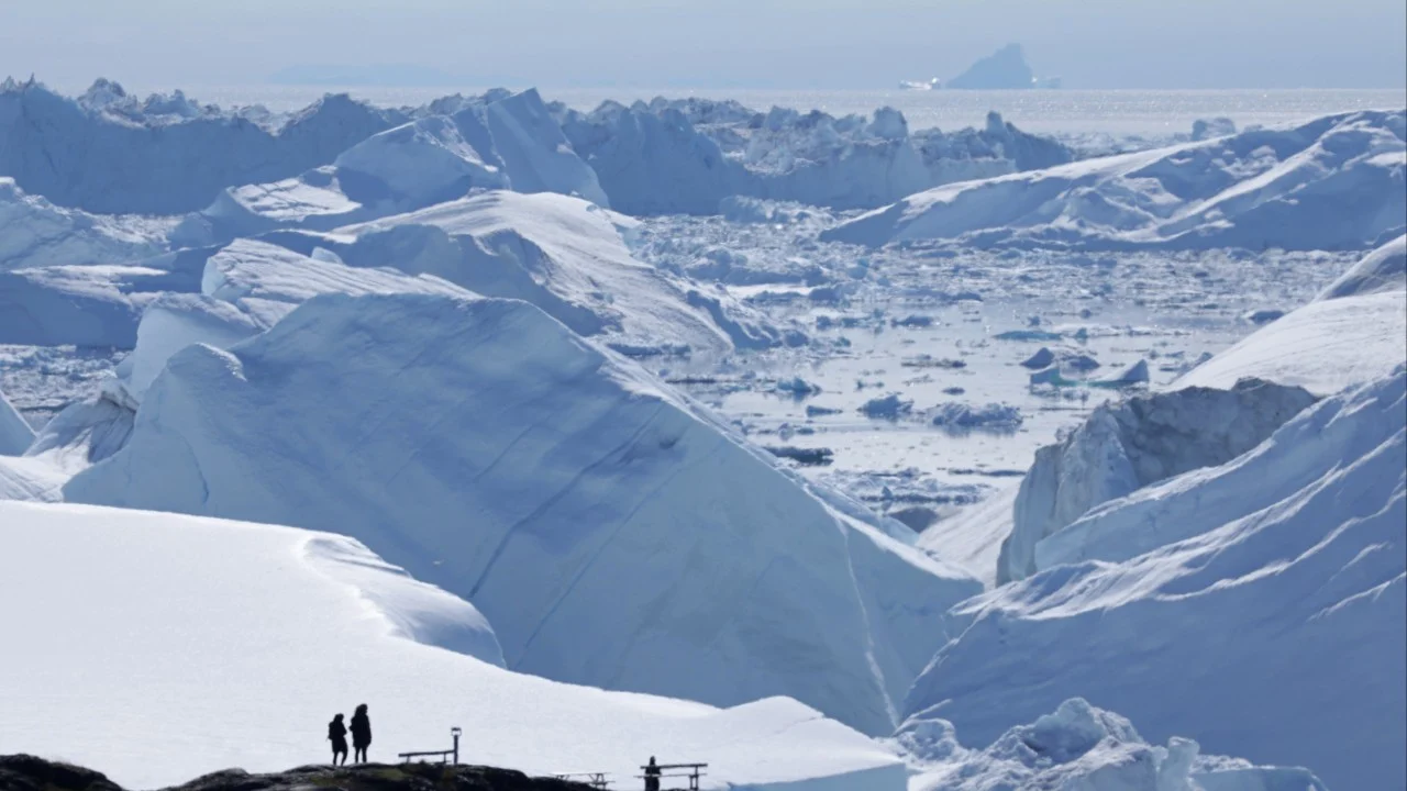
中国研究人员建立了一个新模型,可将格陵兰冰盖的卫星表面高程数据转化为近几十年来冰盖质量损失的详细估算。
Chinese researchers have created a new model to convert satellite surface elevation data for the Greenland Ice Sheet into a detailed estimate of how much ice it has lost in recent decades.
利用覆盖2002年至2023年的卫星高度计数据,他们发现冰盖每年平均损失约1200亿吨(264.5万亿磅)质量。
Using satellite altimetry data covering 2002 to 2023, they found that the ice sheet lost an average of about 120 gigatonnes (264.5 trillion lbs) of mass per year.
这一数字远低于美国国家航空航天局(NASA)得出的被广泛引用的数字,后者此前利用卫星重力数据估算格陵兰每年损失近2700亿吨。
This figure is considerably lower than the widely cited figure reached by Nasa, which previously estimated Greenland’s annual loss to be nearly 270 gigatonnes using satellite gravity data.
这一新数字也低于中国团队利用美国航天局所用的同一数据得出的自身估算值。
The new figure is also lower than the Chinese team’s own estimate derived from the same data used by the US space agency.
较低的数值并不意味着格陵兰的融化程度比之前认为的要轻。相反,研究人员表示,他们的研究旨在改进高程监测,提供一张高分辨率地图,精确显示损失发生的具体位置。
The lower number does not suggest Greenland’s melting is less severe than previously thought. Rather, the researchers said their study sought to refine elevation monitoring to provide a high-resolution map of exactly where the loss was happening.
该团队在10月19日发表于中文期刊《海洋信息技术与应用》的论文中写道:“不同卫星技术的对比显示,卫星高度计在空间分辨率上相较于卫星重力计具有显著优势,能够识别局部冰川中的冰流通道。”
“A comparison between different satellite technologies reveals that satellite altimetry offers a significant advantage in spatial resolution over satellite gravimetry, enabling the identification of ice-flow channels in local glaciers,” the team said in a paper published in the Chinese-language Journal of Marine Information Technology and Application on October 19.
基于重力的数据能提供质量损失总量的完整图景。高度计即高程数据,可提供更精细的1.9公里(1.2英里)分辨率,但需要利用密度将其转化为质量。
Gravity-based data can offer a full picture of how much mass has been lost. Altimetry, or elevation data, can provide a more zoomed-in 1.9km (1.2-mile) resolution, but it needs to be converted into mass using density.
来自中国江苏海洋大学的研究人员开发了一种动态转换模型,能够识别出损失最快的冰川。这有助于减少冰盖动态在时空上的估算不确定性。
The researchers from China’s Jiangsu Ocean University developed a dynamic conversion model that was able to identify glaciers experiencing the most rapid loss. This could help reduce uncertainties in estimates of ice sheet dynamics across space and time.
格陵兰冰盖覆盖了该地区约80%的陆地总面积,是世界第二大冰盖。
The Greenland Ice Sheet covers about 80 per cent of the territory’s total land area and is the second-largest ice sheet in the world.
根据美国国家冰雪数据中心(NSIDC)的数据,该冰盖面积达170万平方公里(65.63万平方英里),含冰量约290万立方公里(69.6万立方英里)。
The sheet stretches across 1.7 million sq km (656,300 square miles) and contains about 2.9 million cubic km (696,000 cubic miles) of ice, according to the US National Snow and Ice Data Centre (NSIDC).
美国国家海洋和大气管理局(NOAA)指出,自20世纪90年代中期以来,该冰盖一直在“实质性地”失去质量。
Since the mid-1990s, the sheet has been losing mass “in earnest”, according to the US National Oceanic and Atmospheric Administration (NOAA).
NOAA表示,这不仅影响海平面,还影响海洋环流和特性、营养物质和沉积物通量,以及当地生态系统,并作为反馈因素助推未来的融化。
This affects not only sea levels but also ocean circulation and properties, nutrient and sediment flux, as well as local ecosystems, contributing as feedback to future melting, NOAA said.
据中国团队介绍,该冰盖最高海拔达3673米(12050英尺),平均厚度约1800米。该冰盖的消融或融化期通常发生在5月至8月。
The sheet’s maximum elevation reaches 3,673 metres (12,050 feet), and the sheet’s average thickness is about 1,800 metres. The sheet’s ablation or melting period typically occurs from May to August, according to the Chinese team.
团队写道:“准确估算格陵兰冰盖质量变化的时空特征,对于理解极地冰盖与全球气候系统之间复杂的反馈关系具有重要的科学意义。”
“Accurately estimating the spatiotemporal characteristics of the mass change of the Greenland Ice Sheet is of great scientific significance for understanding the complex feedback relationship between the polar ice sheet and the global climate system,” the team wrote.
他们补充道,精确确定冰盖质量变化及其发生位置,对于预测未来演变及其对海平面上升的影响也至关重要。
Precisely determining ice mass changes and where they are happening is also important for predicting future evolution and impact on sea level rise, they added.
监测极地冰盖长期质量变化的主要方法之一是卫星重力测量,它通过绘制地球重力场的变化来推算质量损失。
One of the primary methods to monitor long-term ice mass changes in the polar ice sheets is satellite gravimetry, which maps changes in the Earth’s gravitational field and can be used to determine mass loss.
团队表示:“卫星重力测量可直接监测冰盖总质量的相对变化,但其空间分辨率不足以捕捉精细尺度的局部变化。”
“Satellite gravimetry allows for the direct monitoring of relative changes in the total mass of an ice sheet, yet its spatial resolution is insufficient to capture fine-scale, localised variations,” the team said.
另一种方法是卫星高度测量,利用激光或雷达追踪地球表面高程变化。该方法分辨率最好,但将数据转换为质量可能导致估算误差。
Another method is satellite altimetry, which uses lasers or radar to track changes in the Earth’s surface elevation. This method offers the best resolution, but converting the data into mass can lead to estimation errors.
过去几十年间,搭载雷达高度计的卫星被发射升空,用于追踪冰盖高程并监测冰盖变化。
Over the past few decades, satellites equipped with radar altimeters have been launched to track ice sheet elevation and monitor the ice sheets.
2002年,美国国家航空航天局(NASA)与德国航空航天中心发射了两颗卫星,作为“重力恢复与气候实验”(GRACE)的一部分,这些卫星运行至2017年,收集地球重力场数据。其后续任务GRACE-FO于2018年发射。
In 2002, Nasa and the German Aerospace Centre launched two satellites as part of the Gravity Recovery and Climate Experiment (Grace), which orbited until 2017, collecting data on the Earth’s gravity field. Its successor, Grace-Fo, was launched in 2018.
利用GRACE的数据,NASA估计,在2002年至2025年间,格陵兰岛每年损失2640亿吨冰。
Using data from Grace, Nasa estimated that Greenland lost 264 gigatonnes of ice per year between 2002 and 2025.
据中方团队介绍,尽管此前已有利用高度计数据的研究,但这些研究往往侧重于利用该数据对重力测量结果进行降尺度处理或修正。他们表示,缺乏对两种方法得出的质量变化进行系统性比较。
According to the Chinese team, although there had been previous studies using altimetry data, these often focused on using the data to downscale or correct gravimetric results. There was a lack of systematic comparison between mass changes obtained from both methods, they said.
在论文中,该团队提出了一种利用卫星高度计数据估算质量变化的方法,借助名为MAR的气候模型,从而构建动态积雪和冰密度模型。
In their paper, the team proposed a way to estimate mass changes using satellite altimetry data with the help of a climate model called Mar, allowing them to build a dynamic snow and ice density model.
他们利用MAR处理地表高程测量数据,评估了2002年至2023年的质量变化。
They evaluated mass changes from 2002 to 2023 using Mar to process surface elevation measurements.
这些测量数据源自美国国家冰雪数据中心(NSIDC)的多源卫星高度计数据,其中包含了NASA的ICESat卫星测量数据。
These measurements were derived from NSIDC’s multi-source satellite altimetry data, which incorporates measurements from Nasa’s ICESat.
随后,研究人员将其与德克萨斯大学奥斯汀分校发布的基于GRACE卫星质量浓度重力数据得出的结果进行了比较。
The researchers then compared this to the results from Grace-derived satellite-based mass concentration gravity data released by the University of Texas at Austin.
中方团队发现,基于高度计数据,格陵兰冰盖在2002年至2023年间“处于持续质量损失状态”,年损失近1200亿吨。2010年后,冰盖融化速度显著加快。
The Chinese team found that the Greenland Ice Sheet “was in a state of continuous mass loss” between 2002 and 2023, with an annual loss of nearly 120 gigatonnes based on altimetry data. The melting rate of the ice sheet accelerated significantly after 2010.
这意味着总损失约22480亿吨,导致全球海平面上升约6.26毫米(0.25英寸)。
This meant a total loss of about 2,248 gigatonnes, contributing about 6.26mm (0.25 inch) to global sea level rise.
利用重力数据,该团队估算同期22年间的总质量损失约为28300亿吨。冰盖向海洋过渡的西北部和东南部变薄最为显著。
Using the gravity-based data, the team estimated a total mass loss of about 2,830 gigatonnes over the same 22-year period. Thinning was most pronounced in the northwestern and southeastern parts of the ice sheet where the ice transitions into the ocean.
他们发现,沿海的雅各布港冰川、赫尔海姆冰川、坎格鲁苏阿克冰川和79N冰川出现了显著的质量损失信号。
They found that significant mass loss signals were seen in the coastal Jakobshavn, Helheim, Kangerlussuaq and 79N glaciers.
在一些损失严重的流域,他们从高度计数据推导出的质量变化捕捉到的损失明显少于重力测量结果,这表明融化可能发生在冰盖底部这一视野盲区,或者是对冰雪密度的低估。
In some basins with severe loss, the mass change they derived from altimetry data captured substantially less loss than the gravity results, suggesting melting could be out of view in the ice sheet base or an underestimation of ice and snow density.
据中方团队介绍,未来的研究将寻求通过引入现场密度观测,进一步优化密度估算。
According to the Chinese team, future research would seek to further refine density estimates by incorporating on-site density observations.
他们说:“这种综合方法旨在提高卫星高度计推导的质量变化估算精度,为分析冰盖质量长期趋势提供更可靠的数据,并减少极地冰盖对未来海平面上升预测贡献方面的不确定性。”
“This integrated approach is intended to improve the accuracy of mass change estimates derived from satellite altimetry, provide more reliable data for analysing long-term trends in ice sheet mass and reduce uncertainties regarding the contribution of polar ice sheets to future sea-level rise projections,” they said.