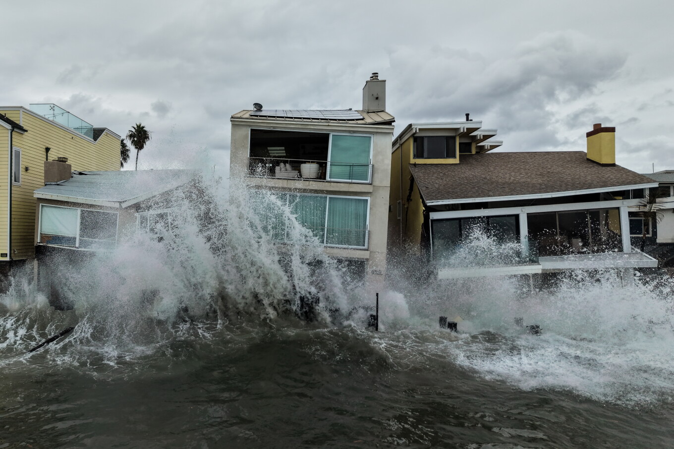
塞思·博伦斯坦 科学家表示,太平洋地区接连出现的巨型飓风打破了国际日期变更线以东地区恶劣且持续时间长的气象纪录,而这一切都源于大自然异常强烈的厄尔尼诺现象。
SETH BORENSTEIN The drumbeat of monster hurricanes in the Pacific has broken a record for nasty long-lasting storms east of the international date line, turbocharged by nature’s supersized El Niño, scientists said.
科罗拉多州立大学的研究员菲尔·克洛茨巴赫从事风暴活动的预测和研究工作。他表示:“自9月20日‘奥达莉斯’形成以来,情况简直失控了。今年,只要形成的风暴都会持续很长时间,并且变得极其强大。”气象学家评估飓风季节的重要指标之一是“累积气旋能量”(ACE),该指标综合了风暴的风速和持续时间。周日,位于日期变更线以东、为夏威夷、墨西哥和美国西海岸输送风暴的太平洋区域,其ACE值超过了2018年创下的旧纪录。
“Since September 20th, when Odalys formed, it’s been berserk,” said Colorado State University researcher Phil Klotzbach, who forecasts and studies storm activity. “This year just everything that forms is just lasting a long time and getting really powerful.”One of the key measurements meteorologists use to judge hurricane seasons is called accumulated cyclone energy, or ACE, which includes a storm’s wind speed and longevity. On Sunday, a section of the Pacific east of the date line, which brews storms headed for Hawaii, Mexico and the U.S. West Coast, passed the old mark set in 2018.
克洛茨巴赫表示,该区域目前仍势头强劲,不仅有“西蒙”飓风,而且似乎即将生成另一场强度将迅速提升的飓风。
The area is still going strong with Hurricane Simon and appears on the verge of spawning another one that will really ramp up in strength, Klotzbach said.
克洛茨巴赫指出,到周二,太平洋地区将有连续多日出现飓风,追平历史纪录,并很可能很快打破这一纪录。
On Tuesday, the Pacific will tie a record for most days with a hurricane spinning and is likely to break it soon after that, Klotzbach said.
亚利桑那州大学的大气科学家金·伍德表示:“感觉上,几乎所有能够形成旋转风暴的条件都已具备。”
“It feels like almost everything that can spin up does spin up,” said University of Arizona atmospheric scientist Kim Wood.
克洛茨巴赫及其他飓风研究人员指出,多种气象因素共同作用,极大地增强了太平洋地区的飓风活动,其中最主要的是厄尔尼诺现象。厄尔尼诺会削弱并改变高空垂直风,而这类风通常会抑制甚至摧毁风暴。在太平洋地区,这种风切变呈东西走向,通常与风暴移动方向一致,就像顺风骑自行车一样,克洛茨巴赫解释道。
Several meteorological factors have come together to supercharge the Pacific, chief among them the El Niño, Klotzbach and other hurricane researchers said. An El Niño weakens and shifts the high altitude vertical winds that otherwise can dampen or even decapitate storms. In the Pacific, that wind shear runs east to west, generally with the direction storms travel, so it’s like riding a bicycle with a tail wind, Klotzbach said.
与此同时,这种天气模式也抑制了大西洋地区的飓风活动,目前该地区的ACE值不足正常年份同期水平的18%。他表示,厄尔尼诺使大西洋的风切变变得如同逆风骑行。
Meanwhile, the weather pattern has dampened hurricanes in the Atlantic, where the ACE is less than 18% of what’s normal for this time of year. El Niño makes the wind shear in the Atlantic like riding into a headwind, he said.
另一个因素是温暖的海水,它是飓风的燃料。根据定义,厄尔尼诺是指赤道太平洋的变暖,它会改变全球天气。在太平洋风暴盆地,海水比正常温度高出几华氏度,阿尔巴尼大学大气科学教授克里斯滕·科博斯里罗说。
Another factor is warm water, which serves as hurricane fuel. By definition El Niño is a warming of the equatorial Pacific that changes weather worldwide. In the Pacific storm basin, it’s several degrees Fahrenheit warmer than normal, said University at Albany storm atmospheric sciences professor Kristen Corbosiero.
通常情况下,太平洋的额外暖水——有利于风暴形成——并不像大西洋那样深。因此,当一个风暴经过一片海域时,它会把冷水带上来,使得同一区域随后的风暴难以维持,伍德说。但今年情况不同。
Usually in the Pacific, the extra warm storm-friendly water doesn’t run as deep as it does in the Atlantic. So when one storm goes over a patch of water, it brings up cold water and makes it hard for a subsequent storm in the same area to stay alive, Wood said. But not this year.
伍德说,飓风瑞秋的残留在周末淹没了拉斯维加斯,但它在经过时并未受到太大影响,因为它被五级飓风波洛搅动。她说,海水之所以温暖,既有厄尔尼诺的影响,也有燃烧煤炭、石油和天然气导致的气候变化。
Hurricane Rachel, whose remnants swamped Las Vegas over the weekend, didn’t suffer as it went over, churned up by Category 5 Hurricane Polo, Wood said. She said the waters are warm from both El Niño and climate change from the burning of coal, oil and gas.
近期风暴的另一个因素是中美洲上空的逆时针大气旋转——称为环流——它会喷出可能发展成飓风的恶劣天气“种子”。科博斯里罗和克洛茨巴赫说,它几乎同时喷出了大西洋的以赛亚斯和太平洋的西蒙。
Another factor in recent storms was a counterclockwise atmosphere spin over Central America — called a gyre — that spits out seeds of stormy weather that can form into hurricanes. It spit out both the Atlantic’s Isaias and the Pacific’s Simon at about the same time, Corbosiero and Klotzbach said.
过去五个太平洋飓风——持续时间长的诺罗、奥达利斯、波洛、瑞秋和西蒙——都达到了主要等级,风速至少为每小时111英里(178.6公里/小时)。诺罗、奥达利斯和西蒙达到四级,而波洛在五级状态下持续了两天半,创造了纪录。
The last five Pacific hurricanes — long-lasting Nolo , Odalys, Polo, Rachel and Simon — have all reached major status with winds of at least 111 mph (178.6 kph). Nolo, Odalys and Simon hit Category 4, while Polo set the record for time spent at Category 5 at two-and-a-half days.
克洛茨巴赫在计算东部和中部太平洋创纪录活动时,他查看了所有日期线以东的风暴。
When Klotzbach made those calculations on the record-breaking activity of the eastern and central Pacific, he looked at all storms east of the date line.
这与国家海洋和大气管理局的方法略有不同,后者将这一广阔区域划分为两个地区。目前,NOAA定义的任一地区尚未达到累积气旋能量(ACE)的纪录水平;但合起来则达到了。
That’s a slightly different approach from the National Oceanic and Atmospheric Administration, which breaks that broad area into two regions. Neither NOAA-defined region is quite at record levels for ACE yet; put together they are.
伍德说,这是因为通常当其中一个副区域更活跃时,另一个并不那么狂暴;但在2026年,两个副区域都处于高度活跃状态。
Part of that is because often when one of those subregions is more active, the other isn’t quite as crazy, but in 2026 they both are hyperactive, Wood said.
“这是双方首次同时如此活跃,”伍德说道。“通常来说,活动更多会集中在其中一方,而今年的情况则表明,整个这一地区都出现了低风切变、温暖海水和高湿度等有利条件。”墨西哥海岸附近存在一个扰动,美国国家飓风中心认为其有90%的可能性发展为热带风暴“特鲁迪”,之后还可能进一步增强为大型风暴,克洛茨巴赫和科尔博西罗表示。
“This is the first year that both sides have been this active together,” Wood said. “Usually it’s kind of focused more on one or the other, so that speaks to just the wide extent across this region of where there’s been that lower shear, those warmer waters, and that higher moisture.”Off the Mexican coast is a disturbance that the National Hurricane Center gives a 90% chance of becoming Tropical Storm Trudy, which then could power up to something big, Klotzbach and Corbosiero said.
“看起来那个区域几乎是一波接一波地出现风暴。因此,如果再有另一场风暴,我也不会感到意外,”科尔博西罗说道。“今年由于厄尔尼诺现象,我们确实具备非常有利的气候条件。因此,只要存在来自环流区或冷锋残余系统的风暴种子,这种情况似乎还会持续一段时间。”
“It seems like that area is just one after another. So I would not be surprised to have another storm,” Corbosiero said. “This year, because of the El Niño, we do have very favorable conditions. So as long as there’s some sort of the seeds either from the gyre or from remnant ends of cold fronts, it seems like this is going to continue for a bit.”