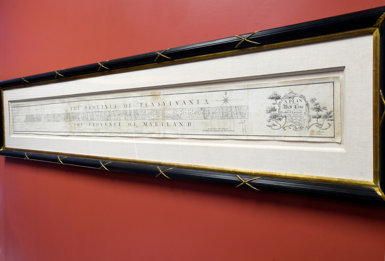
经过短暂的竞价争夺,这张帮助将美国分为南北、自由州与蓄奴州的手绘地图,以95万美元售出。
After a brief bidding war, the manuscript map that helped divide the United States into North and South, free and slave states, sold for $950,000.
美联社 北卡罗来纳州阿什维尔讯——这张展示梅森-迪克逊线的手绘地图,该线最终将美国的自由州与蓄奴州分开,周四以95万美元售出。
ASSOCIATED PRESS ASHEVILLE, N.C. — The hand-drawn map showing the Mason-Dixon Line that eventually divided free from slave states in the U.S. sold Thursday for $950,000.
45名竞拍者为拥有这张或许是美国历史上最具影响力的地图而争夺了不到三分钟。
Forty-five bidders battled just under three minutes for ownership of what is perhaps the most consequential map in American history.
这张由查尔斯·梅森和杰里米亚·迪克逊于1768年完成的、划分梅森-迪克逊线两侧各州的测绘图,起拍价为40万美元。拍卖会在北卡罗来纳州阿什维尔的布朗克拍卖行以线上和线下同步方式举行。
Bidding started at $400,000 for the survey of states divided by the Mason-Dixon Line, finished in 1768 by Charles Mason and Jeremiah Dixon. The sale was held online and in person at Brunk Auctions in Asheville, North Carolina.
虽然未能达到期望的120万美元高估价,但拍卖行副总裁劳伦·布朗克表示她很满意。“这对一张地图来说是个非常高的价格,”她说。布朗克表示,买家要求保持匿名,至少暂时如此。
While it didn’t fetch the hoped-for $1.2 million high estimate, auction house Vice President Lauren Brunk said she was pleased. “It’s a very high price for a map,” she said. Brunk said the buyer asked to remain anonymous, at least for the time being.
这项测绘最初是为了解决当时马里兰殖民地和宾夕法尼亚殖民地之间的边界争端而委托进行的。它在1820年的密苏里妥协中被用来确定这个尚处青春期的美国境内人身束缚的界限,并成为四十年后爆发内战的根本分歧的代名词。
The survey was originally commissioned to settle a border dispute between what were then the colonies of Maryland and Pennsylvania. It was used in the 1820 Missouri Compromise to establish the limits of human bondage in the still adolescent United States and became synonymous with the fundamental divisions that exploded into the Civil War four decades later.
已故出版商马尔科姆·福布斯于1982年以36万美元购得这张地图,击败了美国国会图书馆。该文件于2002年被转售,价格为55.6万美元。布朗克表示,美国国会图书馆并非周四的竞拍者之一。
The late publisher Malcolm Forbes bought the map in 1982 for $360,000, beating out the Library of Congress. The document was resold in 2002 for $556,000. Brunk said the Library of Congress was not among Thursday’s bidders.
“我很高兴这张地图将进入一个好的归宿,我们也很高兴在过去几个月里与它相伴,”布朗克说。“能受托将这张地图从一位主人传递给下一位主人,也感觉是一种荣幸。”这张地图中展示特拉华州-马里兰州边界的垂直部分收藏于普林斯顿大学。
“I would like to say I’m thrilled that this is going to a good home and we are so happy to have had it in our presence for these last months,” Brunk said. “It also feels like a privilege to have been entrusted to steward this one owner to the next.”A vertical section of the map showing the Delaware-Maryland border is housed at Princeton University.