研究人员利用网络科学揭示了古代道路如何塑造了欧洲、中东和北非地区的人员流动、通讯以及现代交通基础设施。根据一项国际研究,在罗马帝国庞大的道路网络的部分区域中,现代土耳其最大的两座城市伊斯坦布尔和安卡拉所处的位置比罗马更为核心。该研究考察了近29.9万公里(约18.6万英里)的古代路线及其对现代交通的持久影响。
Researchers used network science to reveal how ancient roads shaped movement, communication, modern transport infrastructure across Europe, Mideast, North Africa Istanbul and Ankara, the two largest cities in modern-day Türkiye, occupied more central positions than Rome in parts of the Roman Empire's vast road network, according to an international study examining nearly 299,000 kilometers (about 186,000 miles) of ancient routes and their lasting influence on modern transportation.
这项题为《网络科学揭示罗马道路系统的结构与持久影响》的研究发表在《自然·通讯》期刊上,运用数学模型和网络科学分析了帝国的交通基础设施。
The study, titled Network Science Reveals the Structure and Lasting Impact of the Roman Road System, published in the journal Nature Communications, analyzed the empire's transportation infrastructure using mathematical models and network science.
研究人员确定了包括古代拜占庭(今伊斯坦布尔)、安基拉(安卡拉,土耳其首都)、安条克(安塔基亚,土耳其南部城市)和科林斯(希腊城市)在内的数座城市,它们在帝国著名的陆路道路系统中作为连接节点的重要性超过了首都罗马。
Researchers identified several cities, including ancient Byzantium (present-day Istanbul), Ancyra (Ankara, Türkiye’s capital), Antiochia (Antakya, southern Türkiye), and Corinth (in Greece), that surpassed the capital Rome in their importance as connecting points within the empire's famed overland road system.
研究结果还表明,近2000年前建立的某些路线至今仍在影响着欧洲、中东和北非的现代交通网络。
The findings also demonstrated how some routes established nearly 2,000 years ago continue to influence modern transportation networks across Europe, the Middle East, and North Africa.
“条条大路通罗马”这一谚语受到研究结果挑战丹麦奥胡斯大学古典考古学副教授、该研究作者之一汤姆·布鲁赫曼斯告诉安纳多卢通讯社,道路在连接横跨辽阔地域的罗马帝国各社区方面发挥了关键作用。
Adage 'All roads lead to Rome' challenged by findings Tom Brughmans, associate professor of classical archaeology at Denmark’s Aarhus University and one of the study's authors, told Anadolu that roads played a crucial role in connecting communities across the vast Roman Empire.
他说,该网络不仅促进了人员流动,还推动了信息、思想、宗教信仰和疾病的传播。
He said the network facilitated not only the movement of people but also the spread of information, ideas, religious beliefs, and diseases.
布鲁赫曼斯表示,熟知的谚语“条条大路通罗马”起源于中世纪而非罗马时代,主要具有象征意义,并非事实。
Brughmans said the familiar saying "All roads lead to Rome" originated in the Middle Ages rather than the Roman era and was largely symbolic, not factual.
他说,该研究最令人惊讶的发现之一,是确定了在道路网络中比罗马更为核心的城市。
One of the study's most surprising findings, he said, was identifying cities that were more central than Rome within the road network.
“例如,现代伊斯坦布尔,即古代拜占庭,凭借连接欧亚交通的优势,在整个帝国中确实处于非常核心的位置,”他说。
"For example, modern-day Istanbul, or ancient Byzantium, was truly very central within the entire empire by connecting traffic between Europe and Asia," he said.
尽管罗马因其地中海位置仍是重要中心,但布鲁赫曼斯解释说,就陆路运输而言,伊斯坦布尔占据了更核心的位置。
Although Rome remained an important center due to its Mediterranean location, Brughmans explained that Istanbul occupied a more central position in terms of overland transportation.
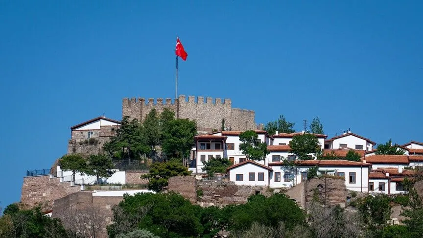
安卡拉在2000年前的战略地位 研究还凸显了古代安基拉(即今安卡拉)的重要性,它曾是罗马加拉太行省的首府。
Ankara strategically positioned 2,000 years ago The research also highlighted the importance of ancient Ancyra, now Ankara, which served as the capital of the Roman province of Galatia.
布鲁赫曼斯说,安卡拉位于小亚细亚腹地的地理位置,使其特别适合组织跨半岛的东西向运输。
Brughmans said Ankara's geographical location in the heart of Anatolia made it particularly suitable for organizing east-west transportation across the peninsula.
他解释说,安基拉位于该行省最核心的道路之一沿线,这使其在成为现代土耳其首都近两千年前,就已具备了作为首都的战略地位。
He explained that Ancyra stood along one of the province's most central roads, making it strategically positioned as a capital nearly two millennia before becoming the capital of modern Türkiye.
伦敦玛丽女王大学数据科学讲师、另一位研究作者马泰奥·马扎穆罗表示,研究人员利用三种网络中心性指标来评估城市的重要性。
Matteo Mazzamurro, a lecturer in data science at Queen Mary University of London and another study author, said researchers assessed the importance of cities using three measures of network centrality.
他们考察了道路连接数量、到达其他地点的便利程度,以及城市作为不同路线桥梁节点的程度。
They examined the number of road connections, accessibility to other locations, and the extent to which cities served as bridges between different routes.
“拜占庭,即后来的君士坦丁堡,也就是现代伊斯坦布尔所在的地区,是一座实实在在地坐落在两大洲交汇处的城市,”他说,指的是欧洲和亚洲。
"Byzantium, or later Constantinople, the area where modern Istanbul is located, is a city literally sitting at the intersection of two continents," he said, referring to Europe and Asia.
马扎穆罗强调,这一地理优势使伊斯坦布尔成为网络中一个特别重要的连接节点。
Mazzamurro emphasized that this geographical advantage made Istanbul a particularly significant connecting point within the network.
古罗马道路继续塑造现代交通 研究人员还发现,一些现代道路沿用了罗马时期确立的路线,特别是在古代定居点保持为重要人口中心的地方。
Ancient Roman roads continue to shape modern transportation The researchers also found that some modern roads follow routes established during Roman times, particularly where ancient settlements have remained important population centers.
布鲁格曼斯表示,工业革命和机动车辆的出现使交通网络发生了巨大变化,但古代与现代路线之间仍保持着显著的连续性。
Brughmans said transportation networks changed considerably following the Industrial Revolution and the introduction of motorized vehicles, but notable continuity between ancient and modern routes remains.
巴塞罗那自治大学的研究员亚当·帕祖特表示,另一个重要发现是通过数学方法确认了罗马行省首府所占据的核心地位。
Adam Pazout, a researcher at the Universitat Autonoma de Barcelona, said another important finding was the mathematical confirmation of the central positions occupied by Roman provincial capitals.
他指出,许多道路,特别是帝国边境沿莱茵河、多瑙河和幼发拉底河附近的道路,是为满足军事需求而修建的。
He noted that many roads, particularly near the empire's frontiers along the Rhine, Danube, and Euphrates rivers, were developed to meet military requirements.
在土耳其东部安纳托利亚地区,一些穿越托罗斯山脉、海拔约达2000米(6562英尺)的路线同样与军事需求相关,尽管周边地区定居点稀少,这些路线仍连接着边境部队。
In eastern Anatolia, Türkiye, some routes reaching elevations of approximately 2,000 meters (6,562 feet) in the Taurus Mountains were similarly linked to military needs, connecting frontier units despite limited settlements in surrounding areas.
帕祖特表示,还需要更多研究来确定行省首府的核心地位主要是地理因素造成的,还是罗马人刻意规划的结果。
Pazout said more research is needed to determine whether the centrality of provincial capitals resulted primarily from geography or deliberate Roman planning.
数字地图为研究者开辟新机遇 伊斯坦布尔大学历史学教授哈姆迪·萨欣提供了土耳其南部奇里乞亚山区的数据,他强调考古证据在重建古代路线中的重要性。
Digital map opens new opportunities for researchers Hamdi Sahin, a professor of history at Istanbul University who contributed data from mountainous Cilicia in southern Türkiye, emphasized the importance of archaeological evidence in reconstructing ancient routes.
他说,研究者依靠里程碑、历史文献和现存的铺装道路来识别交通网络。
He said researchers rely on milestones, historical texts, and surviving paved roads to identify transportation networks.
据萨欣介绍,土耳其每年仍会新发现400至500块铭文,包括里程碑和其他与古代道路相关的证据。
According to Sahin, between 400 and 500 new inscriptions are still discovered annually in Türkiye, including milestones and other evidence related to ancient roads.
国际研究团队还开发了一个高分辨率数字数据集,覆盖约29.9万公里(约18.6万英里)的罗马道路。
The international research team also developed a high-resolution digital dataset covering approximately 299,000 km (about 186,000 mi) of Roman roads.
公开可访问的Itiner-e平台允许研究者探索古代路线和定居点,为考古学、历史学、经济地理学和交通学研究提供了新机遇。
The publicly accessible Itiner-e platform allows researchers to explore ancient routes and settlements, providing new opportunities for studies in archaeology, history, economic geography, and transportation.
研究人员希望这些发现能为进一步探究古代基础设施如何塑造经济活动、城市发展以及区域间联系奠定基础。
The researchers hope the findings will serve as a foundation for further investigations into how ancient infrastructure shaped economic activity, urban development, and connections between regions.
*
*Written by Seyit Kurt