洪水:研究显示尼泊尔和印度北阿坎德邦建设热潮使30万人处于潜在喜马拉雅灾害路径上旅游设施、住房和基础设施的建设在尼泊尔部分地区和印度北阿坎德邦激增。文/纳文·辛格·卡德卡一项新研究表明,喜马拉雅地区部分区域至少有30万人可能正生活在潜在灾害的路径上。
Floods: Building boom in Nepal and India's Uttarakhand puts 300,000 people in path of potential Himalayan disasters, study suggests The construction of tourism facilities, housing, and infrastructure has surged in parts of Nepal and India's Uttarakhand. By Navin Singh Khadka At least 300,000 people in parts of the Himalayan region could now be living in the path of potential disasters, a new study suggests.
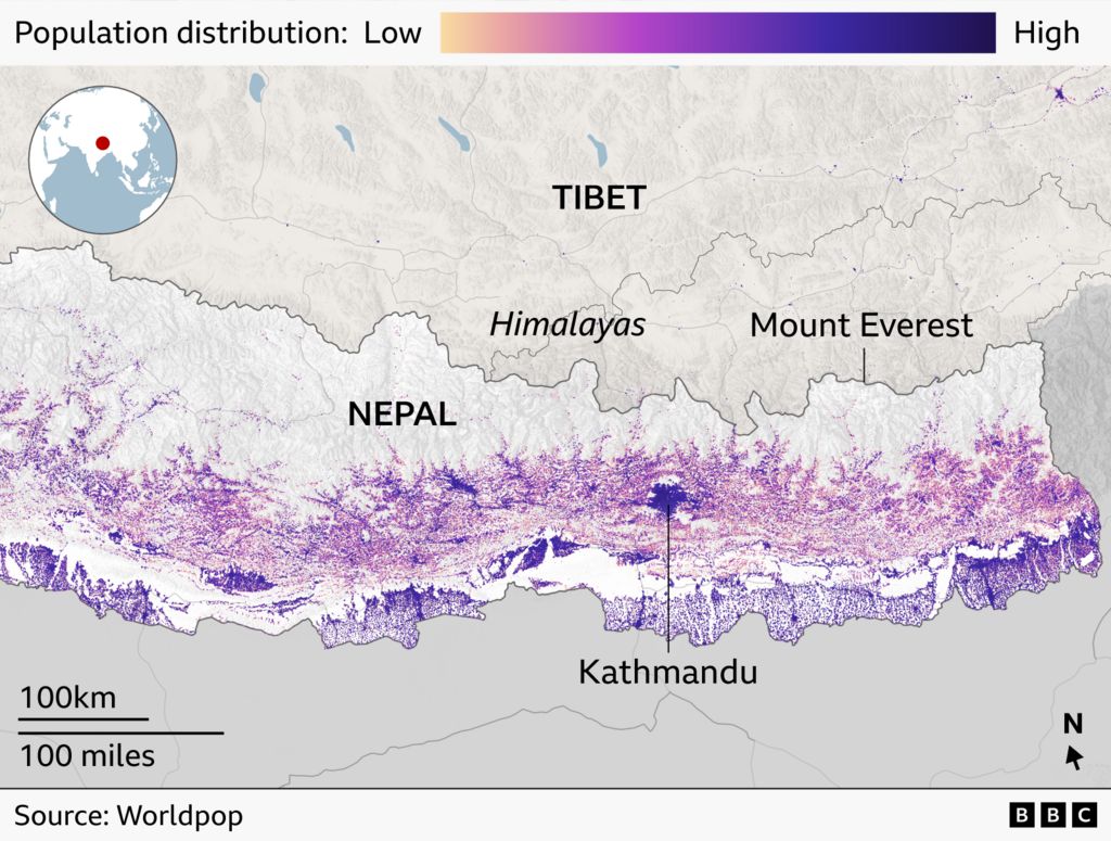
研究人员发现,2016年至2023年间,尼泊尔北部、西藏东南部部分地区和印度北阿坎德邦一角的高风险区建设用地面积增长了约45%。
Researchers found that the amount of built-up land in high-risk zones in northern Nepal, parts of south-eastern Tibet and a corner of India's Uttarakhand had grown by about 45% between 2016 and 2023.
根据发表在《科学报告》上的这项经过同行评审的研究,在受冰湖洪水威胁特别严重的区域,发展速度甚至更快,同期增长了近78%。
In areas particularly threatened by flooding from glacial lakes, development increased even faster, rising by almost 78% over the same period, according to the peer-reviewed study published in Scientific Reports.
研究团队表示,受威胁的真实人数可能要高得多,因为他们只分析了特定领土,而未涵盖面临类似风险的邻近地区。
The team of scientists behind it said the true number of people under threat could be much higher, as they only analysed a specific territory and not neighbouring areas which face similar risks.
该研究是在8月尼泊尔发生毁灭性特大洪水之前进行的,那次洪水造成1400多人死亡、数千人失踪。最近还发生了几起较小事件,包括10月11日布迪甘达基河发生洪水,损毁200所房屋、冲毁5座桥梁,造成5人失踪。
The study was carried out before August's devastating mass floods which left more than 1,400 dead and thousands missing in Nepal. More recently there have been several smaller incidents, including flooding along the Budhi Gandaki river on 11 October that damaged 200 houses, swept away five bridges and left five people missing.
来自英国、尼泊尔和印度的9名研究人员考察了喜马拉雅河流下游50公里(30英里)范围内的区域,以及约1360个冰湖周边。
Nine researchers from the UK, Nepal and India looked at areas up to 50km (30 miles) downstream from Himalayan rivers, as well as around 1,360 glacial lakes.
他们发现这些区域存在显著开发——包括旅游设施扩张、基础设施建设和房地产开发。
They found significant development in these areas - including an expansion of tourism facilities, infrastructure development and real estate.
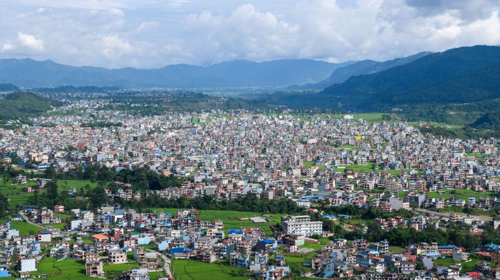
这一点在博卡拉表现得尤为明显,这个位于喜马拉雅山脚下的主要旅游枢纽在过去30年里显著扩张,以接待大幅增加的游客。
It's clear in Pokhara, a major tourism hub at the foot of the Himalayas that's grown significantly in the past 30 years to cater for a massive increase in visitors.
市长达纳·拉吉·阿查里亚表示,应对塞提甘达基河带来的风险是一项巨大的挑战,该河发源于安纳普尔纳山脉,穿城而过。他说,尽管新规要求建筑与河岸保持更大距离,但许多老建筑距离河岸仅有5米(16英尺)。
Mayor Dhana Raj Acharya says it's a huge challenge to deal with the risk posed by the Seti Gandaki River, which stems from the Annapurna mountain range and flows right through the city. Many old buildings are just 5m (16ft) from river banks, he says, despite new rules requiring them to be further away.
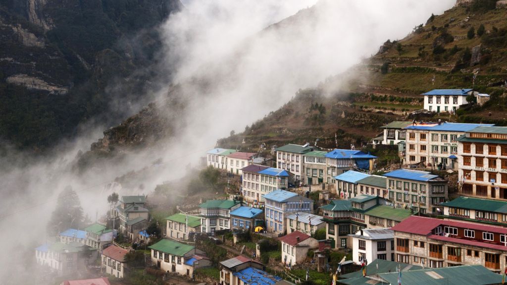
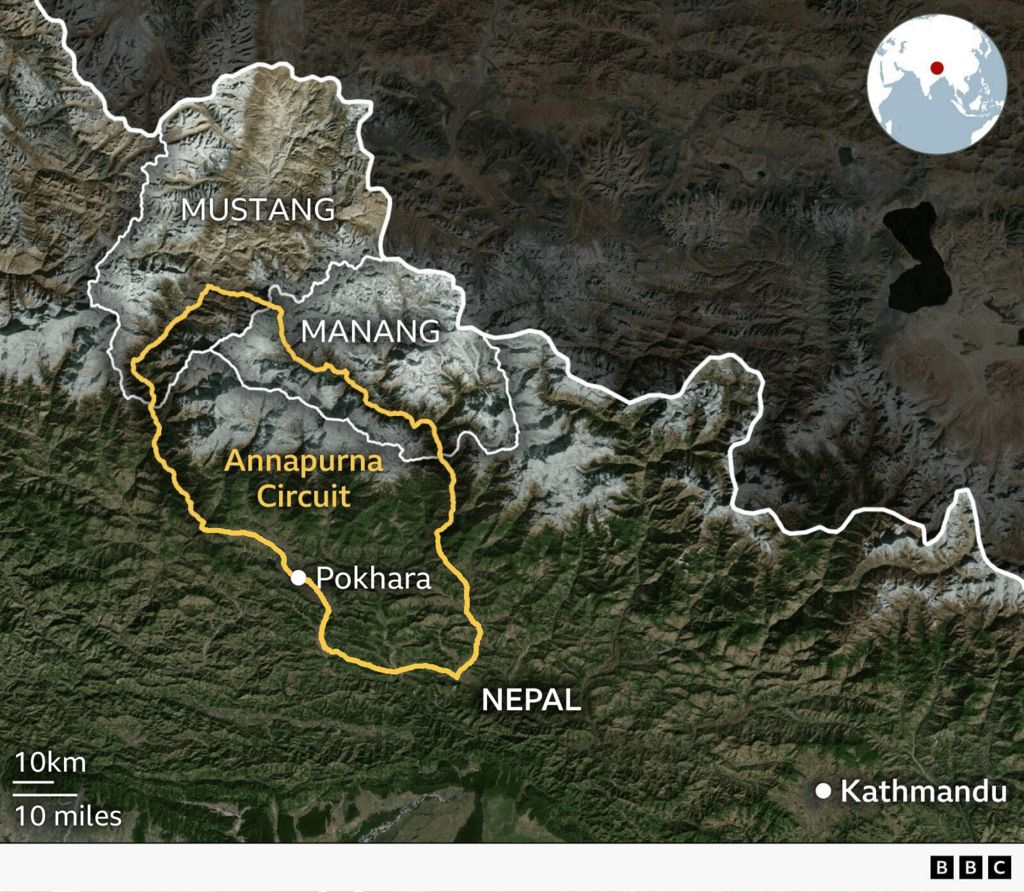
“把它们迁到哪里,以及如何迁移,才是真正的挑战。”北部是世界闻名的安纳普尔纳徒步旅行区,那里沿河岸的定居点也大幅增加——其中一些近期遭遇了洪水和山体滑坡。
"Where we move them, and how we do that, is the real challenge." To the north is the world-renowned Annapurna trekking region that has also seen a major increase in settlements along river banks - some hit by recent floods and landslides.
经营一家家庭旅馆的普尔帕·奇林·拉玛感到无助。通常每年这个时候——徒步旺季——他的20间客房都会客满,但现在只有5间有客人入住。“我们做这行已经40多年了,但从未见过这种灾难。”
Phurpa Chhiring Lama, who runs a homestay there, feels helpless. Normally all of his 20 rooms are occupied at this time of year - the peak trekking season - but now only five are. "We have been doing this business for more than 40 years, but we've never seen this kind of disaster."
克里希纳·高钱的酒店靠近冰川补给的莫迪河,他也很担忧。“如果冰川崩塌或冰湖溃决,这条河就会发洪水,我们生活在持续的恐惧中。”特里布文大学一所地方分校的地理学家卡根德拉·波德尔指出,旅游投资者将其中一些地点作为旅游目的地进行推广,却未将风险纳入考量。这与印度北部喜马拉雅山谷部分地区的情况相似,那些山谷承接大型朝圣活动。
Krishna Gauchan, whose hotel is close to the glacier-fed Modi river, is worried too. "This river can flood if the glacier collapses or if the glacial lake bursts out and we are living in constant fear." Tourism investors promote some of these spots as destinations without factoring in the risks, suggests Khagendra Poudel, a geographer at a local campus of Tribhuvan University. It's similar to what's happening in parts of north India's Himalayan valleys which host major pilgrimages.
博克拉酒店协会会长拉克什曼·苏贝迪承认,该地区旅游业务“在没有任何妥善规划的情况下”扩张,且推广方式“杂乱无章”。
The president of the Hotel Association Pokhara admits tourism businesses have expanded "without any proper planning" in the region and been promoted "haphazardly".
“等到灾害发生时,为时已晚,”苏贝迪说。“作为一个专业团体,我们正试图在旅游企业家和投资者中提高意识。”但不仅仅是旅游业。博特科西河和特里苏利河周边地区,水电站建设也显著增加。
"By the time disasters hit, it is too late," says Laxman Subedi. "As a professional body we are trying to create awareness among tourism entrepreneurs and investors." But it's not just tourism. The regions surrounding the Bhotekoshi and Trishuli rivers have seen a significant rise in the construction of hydropower plants.
“随着河谷人口日益增多,今天所作的开发决策将在未来数十年决定灾害风险,”该研究的首席作者、利兹大学冰川学家C Scott Watson警告道。而实际上受到威胁的建筑物可能比研究人员所识别的更多。
"As river valleys become increasingly populated, development decisions being made today will shape disaster risk for decades to come," warns the study's lead author, University of Leeds glaciologist C Scott Watson. And even more buildings may be under threat than those identified by the researchers.
该研究将风险建筑定义为所有位于河流或冰川湖面上方50垂直米(约164英尺)范围内的建筑。
The study categorised buildings at risk as all those that were within 50 vertical metres (164ft) of a river or glacial lake's surface.
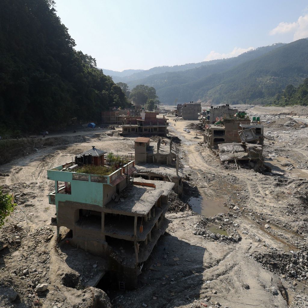
但在8月26日的灾难性洪水期间,拉苏瓦区的当地居民称,河流水位在部分地区上升了70米(约230英尺)——因此即使相对远离河岸的建筑也被泥石流埋没。
But during the catastrophic flooding on 26 August, locals in Rasuwa district say the river level had risen by 70m (230ft) at some points - so even buildings that were relatively far from the river banks were hit and buried by debris-sludge.
这些地区的风险主要源于喜马拉雅地区的变暖,科学家称该地区的变暖速度是全球平均的两倍。这加速了冰川、冰原、积雪以及全年冻结的地下冰的融化。
The risks in all of these areas are largely driven by warming in the Himalayan region, which scientists say is happening at twice the global rate. This has sped up the melting of glaciers, icefields, snowpacks, and ground that's normally frozen all year.
进而可能使本已频繁受到地震震动的山坡失稳,导致下游出现毁灭性灾害。
This can, in turn, destabilize mountain slopes which are also frequently shaken by earthquakes, unleashing devastating disasters downstream.
快速融化还使冰川湖不断蓄水并扩大,直至破裂,引发致命洪水。尼泊尔自1940年以来已记录约30起此类事件。
The rapid melting is also filling up and expanding glacial lakes until they burst, causing deadly floods. Nepal alone has documented around 30 of these events since 1940.
另一个问题是气温升高使降雨能够到达高海拔地区,而这些地区过去仅有降雪,导致坡面失稳、落石和落冰等灾害。
Another issue is that rising temperatures cause rain to reach high altitudes where it used to only snow, leading to slope failures, rock and ice falls, and other disasters.
尼泊尔总理巴伦德拉·沙(Balendra Shah)在最近的联合国大会演讲中提出气候变化的危害,他表示该国正为一场并非自身造成的危机付出“巨大的代价”。
Nepal's Prime Minister Balendra Shah raised the dangers of climate change at his recent UN General Assembly speech, where he said his country was paying a "colossal price" for a crisis it did not create.
“每一次重大灾害都可能抹去多年的发展成果。它迫使一个贫穷国家借债来修复并非自身造成的损失。”未参与本研究的科罗拉多大学山地地理学家阿尔顿·拜尔斯(Alton Byers)表示,这项研究应成为推动更有效预警系统和其他防范措施的“跳板”。
"Every major disaster threatens to erase years of development. And it forces a poor country to borrow money to repair damage it did not cause." Alton Byers, a mountain geographer at the University of Colorado who was not involved in the study, says it should serve as a "springboard" to bring about more effective early-warning systems and other precautionary measures.
但实现这一目标将是一项挑战。活动人士表示,建筑法规没有在实地落实,多年来,太多地方的开发都是杂乱无章的。
But achieving that will be a challenge. Campaigners say building regulations aren't implemented on the ground and through the years, development has been haphazard in too many places.
城市规划专家、尼泊尔大学注册主任苏里亚·拉杰·阿查里亚教授表示,道路、水电项目、酒店和集镇在河流沿岸低洼平坦的土地上不断扩张,因为这些土地易于到达且适合建设。他补充说,相关责任方往往无视保护措施,包括远离河岸。
Roads, hydropower projects, hotels and market towns have expanded on the low, flat land along rivers, which is accessible and buildable, says Prof Surya Raj Acharya, an urban planning expert and registrar at the University of Nepal. Those responsible have often ignored safeguards including keeping off the river bank, he adds.
“像喜马拉雅这样脆弱的生态系统需要比其他地方更严格的规划和建筑法规,然而这些规则一直薄弱且执行不力。”尼泊尔当局表示,他们正在努力解决这些问题。据国家灾害机构称,在近期遭受严重破坏的拉苏瓦-波特科西走廊,距河岸15米(49英尺)以内的定居点很快将被禁止。其他河流走廊也即将出台类似规定。
"A fragile ecosystem like the Himalaya demands stricter planning and building regulations than elsewhere, yet these rules have been weak and poorly enforced." Authorities in Nepal say they are working to address these issues. Settlements within 15m (49ft) of the riverbank along the recently devastated Rasuwa-Bhotekoshi corridor will soon be banned, according to the national disaster agency. Similar rules are being introduced in other river corridors soon.
“这是一项艰巨的工作,因为许多地方的人们对自己的土地和财产怀有情感依恋,但我们不能忽视日益增加的风险,”首席执行官达拉姆·拉杰·乌普雷蒂说。
"It is a challenging job because people in many places have sentimental attachments with their land and property but we cannot ignore the increasing risks," says chief executive Dharam Raj Uprety.
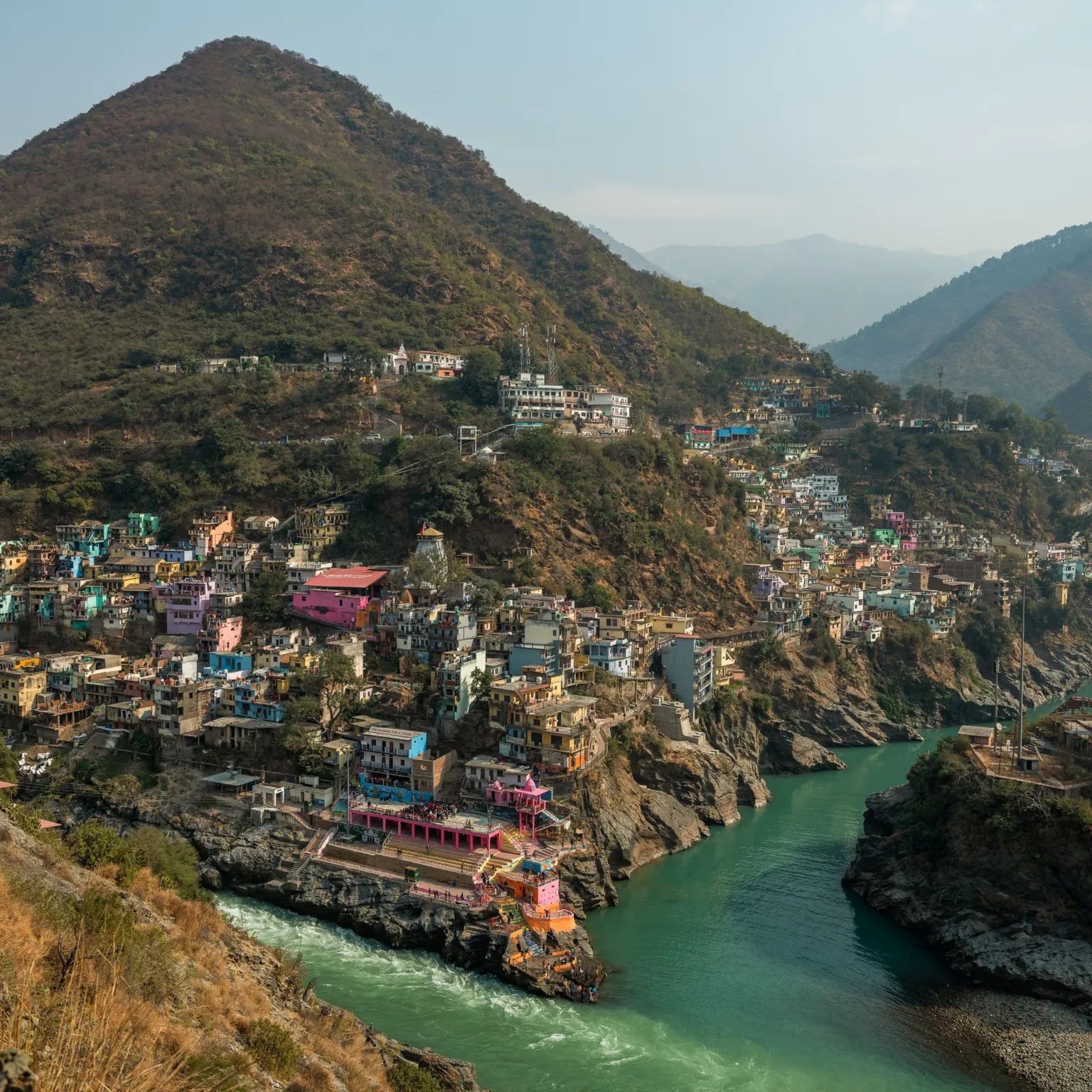
活动人士阿努普·瑙蒂亚尔声称,在尼泊尔西部边境另一侧的印度北阿坎德邦,也上演了类似的情况,那里以经济增长为名,旅游上限和环境法规被绕过。
A similar story has unfolded across Nepal's western border in India's Uttarakhand state, where maximum tourism limits and environmental regulations have been bypassed in the name of economic growth, claims activist Anoop Nautiyal.
纸面上有分区规则,禁止在离河岸太近的地方建造房屋和基础设施,“但在实地,我们看不到这些规则的执行。
On paper there are zoning rules prohibiting the construction of houses and infrastructure too close to river banks, "but on the ground we see no implementation of such rules.
“你可以看到到处都是肆意建设。”北阿坎德邦政府于10月12日批准了新的洪泛区分区规则,以规范土地使用和开发。“其目标是保护生命、财产和重要基础设施免受可能的洪水破坏,同时保持洪水的自然流动,”该邦内阁决定中写道。
"You can see rampant construction all over." The Uttarakhand government on 12 October approved new floodplain zoning rules to regulate land use and development. "Its objective is to protect life, property and important infrastructure from possible flood damage while maintaining the natural flow of flood waters," the state's cabinet decision read.
但特里布文大学灾害研究中心主任巴桑塔·拉杰·阿迪卡里认为,完全缓解此类威胁是不可能的。
But Basanta Raj Adhikari, director of the Centre for Disaster Studies at Tribuvan University, thinks it will not be possible to mitigate such threats completely.
他建议,保险评级可以成为鼓励人们在风险较低地区建房的另一种方式。他认为,如果当局将各地划分为高风险、中等风险和低风险区域,保险覆盖范围将“相应跟进”,从而确保在更安全地区建房的人获得更好的保障。但就目前而言,整个地区的建设步伐没有放缓的迹象。
Insurance grades, he suggests, could be another way to encourage people to build in less risky areas. If authorities were to map places as high, moderate and low risk, he believes insurance coverage would "follow accordingly" ensuring people who build homes in safer areas get better protection. But for now, the pace of construction across the region shows no signs of slowing.