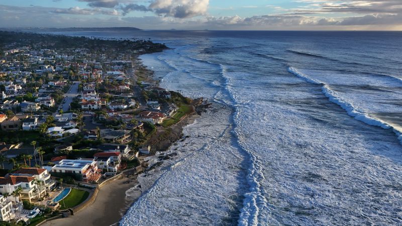
在动荡的东热带太平洋海面之下,潜伏着自1980年有记录以来该地区观测到的最暖海水之一。据多项指标显示,该水体温度较常年同期高出多达18华氏度(约10摄氏度),正缓慢上升至海面,并强化着地球上有观测记录以来最强的超级厄尔尼诺事件。
Beneath the turbulent eastern tropical Pacific Ocean lurks some of the warmest water ever observed in this region since records began in 1980. Measuring up to 18 degrees Fahrenheit above average for this time of year, it is slowly rising to the surface and reinforcing what is already the strongest super El Niño event yet observed on Earth, according to many metrics.
美国国家海洋和大气管理局(NOAA)厄尔尼诺预测团队负责人米歇尔·勒乌雷在一份声明中表示,副表层海水温度“非常非同寻常”。
The subsurface water temperatures are “pretty extraordinary,” said Michelle L’Heureux, who leads the El Niño forecasting team at the National Oceanic and Atmospheric Administration, in a statement.
科学家们表示,让这一厄尔尼诺事件区别于以往所有事件的不仅仅是海洋热含量。这一事件在多个影响全球天气模式的关键方面具有独特性,包括即将到来的冬季北美风暴路径的建立情况。原来,让一个厄尔尼诺事件令人难忘的不仅是其强度,还有它在何时何地增强。请从CNN天气应用程序获取您的预报。
It’s not just ocean heat that makes this El Niño stand out from all others. This event is unique in several consequential ways that affect global weather patterns, including how the winter storm track sets up across North America this coming season, scientists said. Turns out, what makes an El Niño memorable isn’t just its strength, but where and when it ramps up. Get your forecast from the CNN Weather app.
大部分关注点都集中在这一厄尔尼诺事件的强度上,专家指出,这是其超越19世纪以来为数不多的超级厄尔尼诺事件的最大方式之一。
Much of the attention has focused on the intensity of this El Niño event, and experts pointed to this as one of the biggest ways in which it is a cut above the handful of super El Niños that have occurred since the 1800s.
勒乌雷表示,强厄尔尼诺事件会增加通常影响出现的几率,例如美国西海岸冬季比常年湿润,但创纪录或接近创纪录的强度本身并不保证这些影响一定会发生。
Strong El Niño events increase the odds of typically seen impacts, such as wetter than average winters along the US West Coast, though the record to near-record intensity itself does not guarantee these impacts will occur, L’Heureux said.
但据美国国家气象局延伸预测部气象学家林赛·朗表示,这一厄尔尼诺事件增强得也很快。“2026年初我们仍处于拉尼娜条件下,但到7月,该事件已显示出仅次于1997至1998年超级厄尔尼诺事件的月度海表温度数值,”朗在一份声明中说。这标志着热带太平洋海水从低于常年平均水平的冷水状态,极快地转向了极端暖性异常状态。
But this El Niño also ramped up quickly, according to Lindsey Long, a meteorologist with the National Weather Service’s Extended Prediction Division. “At the beginning of 2026, we were still under La Niña conditions, but by July, the event was already showing monthly sea surface temperature values second only to the” 1997 to 1998 super El Niño, Long said in a statement. That marks an extraordinarily fast pivot from colder-than-average waters in the tropical Pacific to extremely warm anomalies.
科学家表示,此次厄尔尼诺现象的快速形成和增强,与过去一些超强厄尔尼诺事件的情况一致。据勒厄雷表示,强厄尔尼诺事件在日历年内往往比弱事件开始得更早。这种早且快的开端,可能在抑制2026年大西洋飓风季方面发挥了关键作用。
The rapid onset and intensification of this El Niño is consistent with some past super El Niño events, scientists said. Strong El Niño episodes tend to begin earlier in the calendar year than weaker ones, according to L’Heureux. This early and fast start may have played a crucial role in stifling the 2026 Atlantic hurricane season.
最强的厄尔尼诺事件,其最暖海水中心通常位于国际日期变更线以东很远的地方,即中东部热带太平洋。今年的超强厄尔尼诺也不例外。科罗拉多大学博尔德分校的大气科学家克里斯·卡尔瑙斯卡斯表示,这是一个“东太平洋型厄尔尼诺的教科书式案例”,这对其如何显著影响南美部分地区的天气和海洋状况具有重要意义。
The strongest El Niños tend to have their warmest water centered well to the east of the international dateline, in the central and eastern tropical Pacific. This year’s super El Niño is no exception. Kris Karnauskas, an atmospheric scientist at the University of Colorado Boulder, said it is a “textbook example of an East Pacific El Niño,” which has implications for how significantly it is affecting the weather and ocean conditions in parts of South America.
他表示,暖水异常的位置对大气如何响应、以及我们可能在何处看到一连串强烈冬季风暴沿着急流移动,影响极大——急流是位于高空、引导风暴移动的狭窄气流通道。
The location of the warm water anomalies also matters a great deal for how the atmosphere responds, and where we may see a parade of intense winter storms riding the jet stream — a narrow highway of storm-steering air at high altitudes — he said.
例如,一些研究表明,与最热海水位于中太平洋的厄尔尼诺事件相比,东部型厄尔尼诺与加州更湿润的冬季有关。不过,这仍是一个活跃的研究领域。
For example, some studies indicate that east-based El Niños are tied to wetter winters in California, when compared to El Niño events in which the hottest water is in the central Pacific. However, this is still an area of active research.
卡尔瑙斯卡斯表示,正在进行的这次厄尔尼诺之所以独特,还在于它在出现后不久就极其有效地终结了大西洋飓风季。
Another way in which the ongoing El Niño is unique is how effective it was at shutting down the Atlantic hurricane season very soon after coming on the scene, Karnauskas said.
通常,大气对厄尔尼诺发展的响应存在滞后,即热带太平洋条件发生变化与更远距离的大气影响出现之间有一段间隔时间。预报员最初预测飓风季将略显活跃但低于平均水平,因为厄尔尼诺可增强热带大西洋上空的高空风,这些风能将风暴撕裂,并从一开始就阻止其形成。但本季,那些高空风强得惊人,且极少减弱。
Typically, the atmosphere responds to the development of an El Niño with more lag time between when conditions change in the tropical Pacific and more distant atmospheric impacts occur. Forecasters initially predicted a somewhat active but below average hurricane season, since El Niño can increase upper atmospheric winds across the tropical Atlantic, which can tear storms apart and prevent them from forming in the first place. But this season, those upper-level winds were off-the-charts strong and rarely relented.
虽然飓风季要到11月30日才正式结束,但可以肯定地说,这将是近代史上最不活跃的飓风季之一。预计不再会有新的风暴生成,本季仅产生了1个飓风,命名风暴总数为10个。长期平均水平为7个飓风和14个命名风暴。这是自1925年以来,大西洋飓风季首次仅出现单个飓风。
Though hurricane season does not end until November 30, it’s safe to say this will go down as one of the least active in recent history. No more storms are expected, and the season has produced just one hurricane and a total of 10 named storms. The long-term average is seven hurricanes and 14 named storms. This was the first Atlantic hurricane season to feature just a single hurricane since 1925.
这一厄尔尼诺现象还与加利福尼亚沿岸发生的非凡海洋热浪有关。从墨西哥边境一直到旧金山及更北地区,加利福尼亚沿岸海水温度均创下或接近同期历史纪录。
This El Niño is also linked to an extraordinary marine heat wave along coastal California. The ocean water along the shore of the Golden State is record or near-record warm for this time of year, all the way from the Mexico border north to San Francisco and beyond.
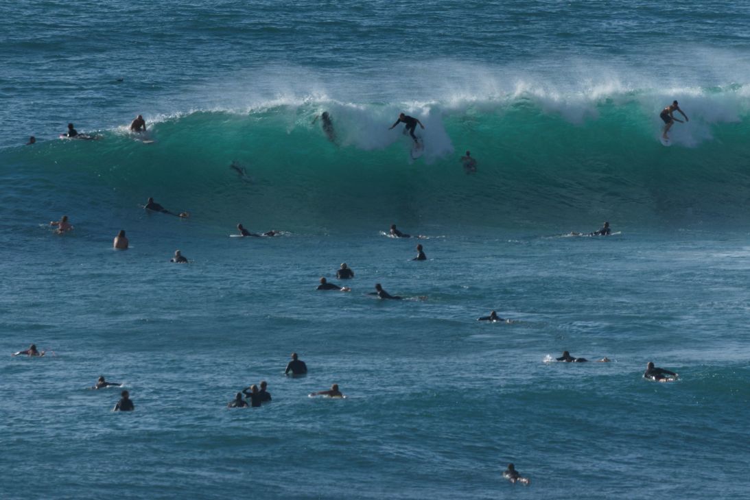
卡尔瑙斯卡斯表示,厄尔尼诺引发盛行表层风向的转变,导致原本维持加利福尼亚近岸海水异常寒冷的现象——即来自海面以下的较冷海水近乎持续不断的上涌——停止了。
Karnauskas said El Niño triggered a shift in prevailing surface winds that has shut down the phenomenon that normally keeps California’s near-shore water remarkably chilly: the near-constant upwelling of colder water from below the ocean surface.
“如果你问几乎任何一位物理海洋学家,如果风向变得不利于上涌,会有什么预期?这正是你应该预期到的海表温度、海洋热浪信号,”卡尔瑙斯卡斯说。这种异常炎热的近岸海水的存在,可能会转化为整个冬季全州更强的降水。
“If you pretty much ask any physical oceanographer of like, what are you going to expect if the winds become unfavorable for upwelling? This is exactly the sea surface temperature, marine heat wave kind of signal you should expect,” Karnauskas said. The presence of this unusually hot nearshore water could translate into even heavier precipitation across the state this winter.
卡尔瑙斯卡斯表示,这个超级厄尔尼诺还存在一个谜团,即人为导致的全球变暖可能在改变其强度和影响方面扮演了什么角色。
There is a mystery to this super El Niño as well, and that is what role human-caused global warming may be playing in altering its intensity and impacts, Karnauskas said.
“我不认为我们作为一个群体真正有那个答案,”他说。“无论你是否将其归因于气候变化,这仍然是一个破纪录的事件,而且它发生在有记录以来最温暖的十年里。所以,我认为这是一个值得探讨的有趣问题。比如,是厄尔尼诺现象放大了影响,还是事件本身就如此?”他将气候变化描述为“房间里的大象”。“我们确实知道的一件事是,大气变暖后能容纳更多水汽。因此我们预期水文极端事件会更加剧烈,”他说,并指出厄尔尼诺现象的许多影响都是通过水循环体现的。
“I don’t think we as a community really have that answer,” he said. “Whether you kind of normalize it for climate change or you don’t, it’s still a record breaker, and it’s happening in a decade where it’s the warmest it’s been on record. So, I think it’s an interesting question to ask. Like, are the impacts supercharged by El Niño, or was the event itself?”He described climate change as “the elephant in the room.”“One thing we do know is that with a warmer atmosphere, it’ll hold more water. So we expect the hydrological extremes to be greater,” he said, noting that many of El Niño’s impacts come through the water cycle.
这意味着一些地区将迎来更强降雨,而另一些地区则会经历更剧烈的干旱,因为这是水循环极端表现的两端。与此同时,厄尔尼诺现象仍在增强。
This means heavier rains for some regions, and more intense drought for others, as these are the two ends of the water cycle’s extremes. And in the meantime, El Niño is still intensifying.